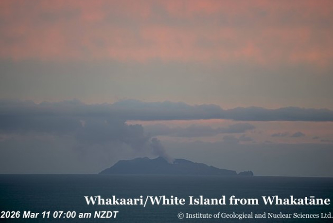
Steam and gas emissions have been visible from Whakaari/White Island over the past week, with white plumes observed from the Bay of Plenty coastline.
GeoNet said small amounts of sulphur dioxide (SO₂) have also been detected by satellite sensors.
An observation flight over the weekend confirmed steam and gas was rising from the active vent, though scientists reported no signs of erupted ash or new rock deposits on the crater floor, duty volcanologist Michael Rosenberg said in an update this week.
The Volcanic Alert Level remains at 2, indicating moderate to heightened unrest, and the Aviation Colour Code stays at Yellow.
Rosenberg said thermal infrared measurements taken on February 10 recorded vent temperatures below 100C.
He said minor rockfalls – likely triggered by recent rainfall – were seen during that flight and in satellite InSAR imagery.
GeoNet’s coastal cameras at Whakatāne and Te Kaha have shown low-elevation plumes this week that occasionally appear larger or change colour because of shifting atmospheric conditions.
“During the past week, SO₂ levels detected by the TropOMI satellite were intermittently above background levels, though scientists noted no ash emissions on those days.
“While such gas release is not unusual for Whakaari, these detections are the first since November 2025.”
Rosenberg said the observations remain consistent with low-level activity described in their previous update.
There is no eruption underway, but Rosenberg cautioned that activity could escalate with little or no warning, potentially affecting the crater floor and immediate area of the island.
“A gas-measurement flight is planned this week to assess any changes in the amounts of volcanic SO₂ and carbon dioxide [CO₂] being emitted.”
Rosenberg said because real-time monitoring instruments on the island are currently unavailable, scientists cannot reliably distinguish between Volcanic Alert Level 1 and 2. As a precaution, the volcano will remain at VAL 2 until on-island monitoring can be re-established.
Earth Sciences NZ’s Volcano Monitoring Group and the National Geohazards Monitoring Centre will continue to track activity using remote cameras, satellite imagery and periodic observation flights.

0 comments
Leave a Comment
You must be logged in to make a comment.