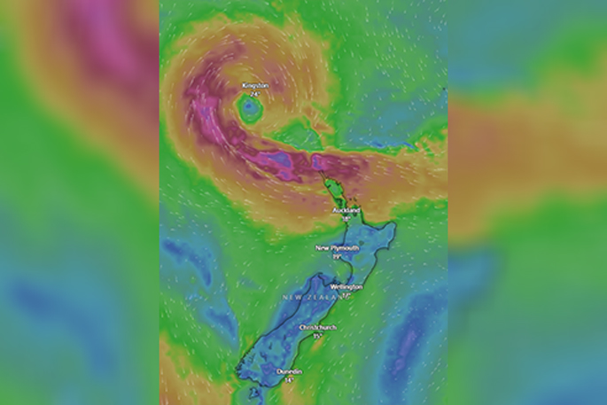
A heavy rain watch has been issued for parts of Bay of Plenty and Coromandel as officials monitor an approaching tropical storm.
Southeast gales and heavy rain will hit the north as a tropical low is expected to close in on the top of the country today.
MetService said a yellow watch for heavy rain was in place for Bay of Plenty, west of Kawerau, from 10pm Thursday to 10am Friday.
The watch was also in place for Coromandel for 12 hours from 6pm Thursday.
Periods of heavy rain with localised downpours were possible, MetService said.
A strong wind watch is in place for the Far North District between 1pm and 10pm today with severe 100km/h gales expected in exposed places.
Simultaneously, another front will move on to Fiordland from the Tasman Sea, bringing wild northwesterlies and a drenching of heavy rain.
MetService meteorologist Gerard Bellam said it was unlikely there would be much relief for most of the country until the weekend, with unsettled conditions for the rest of the week.
“We’ve got periods of rain basically from Wednesday right through Friday ... the first dry day is really Sunday,” Bellam said.
Bellam said other weather alerts are likely to be issued later in the week.
“We have got a high-pressure system over central New Zealand, and so, between that and the low that comes down, it’ll squeeze those isobars fairly tight over northern parts of the country.
“That has triggered a severe weather wind watch.”
On Friday, MetService said, the remnants of the low and the associated front were expected to move across the northern half of the North Island.

0 comments
Leave a Comment
You must be logged in to make a comment.