


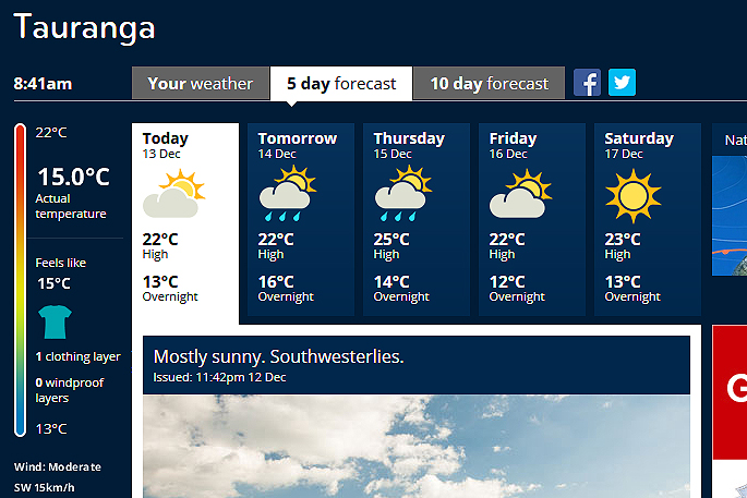
A large high over the north Tasman Sea directs a southwesterly flow over the country to start the week.
This southwest flow brings showers and slightly cooler temperatures to most of the country.
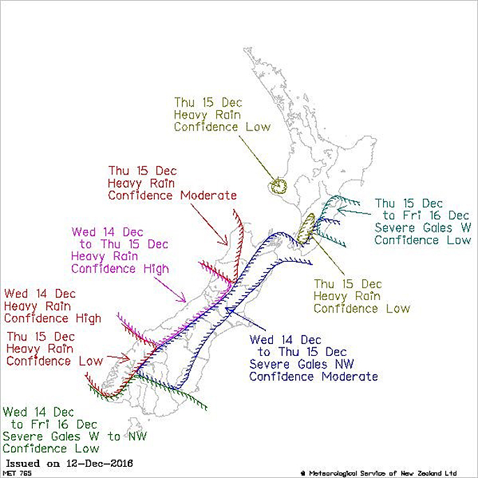
'We can expect strong northwesterly winds for the east of the South Island on Wednesday and Thursday, travelling north to affect the lower North Island into Friday,” says MetService meteorologist Lisa Murray.
'With the northwest winds, temperatures in the east are expected to become warm on Wednesday reaching the mid-twenties. Napier and Hastings are forecast to reach a smouldering 30C on Thursday.”
Severe northwesterly gales are expected in some of the eastern areas, while rain is expected in the west.
'With a number of weather factors to consider, it'd be wise to check the latest forecast for your location at MetService.com before you make your plans for the week.”
Later in the week, the southwesterly flow over the country returns bringing large, long period swell to the west of the country before another front lines up for the second half of the weekend.
Meanwhile in the Tropics, MetService is monitoring the development of a low near Fiji.
You can check the latest tropical cyclone activity update on the MetService website at http://info.metraweather.com/e/60812/ings-tropical-cyclone-activity/c1fr7k/470353850

0 comments
Leave a Comment
You must be logged in to make a comment.