


A lot of people woke up to frosts early on Monday morning, particularly for inland areas of both islands.
Waiouru saw the coldest temperature, with -3.3C. For the South Island, Pukaki Airport was the coldest with -1.3C.
Clear skies overnight were the cause of the frosty temperatures and the fine weather is expected to continue for many this afternoon, though there will be scattered showers across inland North Island, as well as Auckland, Northland and Bay of Plenty, says a statement from the MetService.
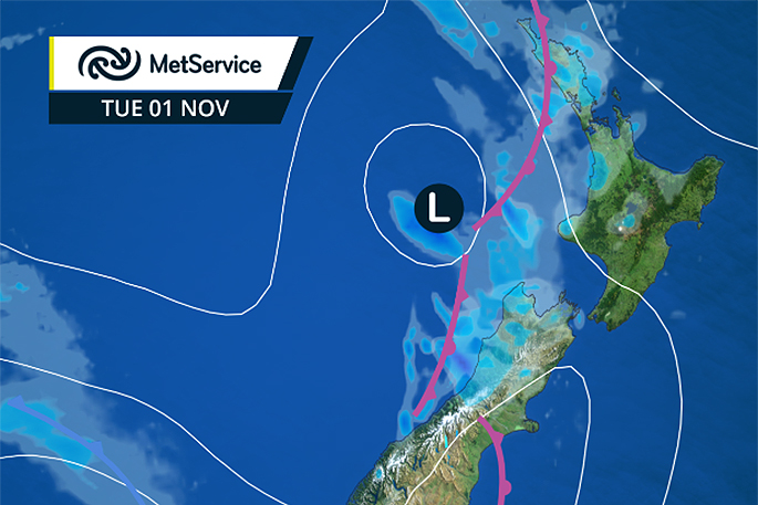
Tomorrow could see another frosty morning before the next front starts moving on, bringing rain to most places by the end of Tuesday. 'This front is approaching from the west, so the West Coast of the South Island will start to see the rain first,” says MetService Meteorologist Claire Flynn.
'Periods of rain will gradually spread eastwards from Tuesday afternoon, bringing rain to most places by the end of the day.” The front will then move away quickly on Wednesday, meaning that the weather will improve.
'Tuesday's front will be followed by several more fast-moving fronts throughout the remainder of this week.
'We've got a front coming through about every other day, so people may notice a trend of a wetter day followed by a drier day.” While cool and changeable weather is predicted for the start of November, you can get details about the rest of the month from the MetService Monthly Outlook which will be updated on November 1, at www.metservice.com/rural/monthly-outlook, or by subscribing to the Monthly Outlook emails at http://info.metraweather.com/e/60812/SubscribeToEmails/bn95qw/443512870

0 comments
Leave a Comment
You must be logged in to make a comment.