


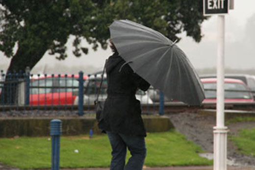
After an overcast and occasionally rainy week is expected to continue through into the weekend.
An easterly flow which brought recent rain to northern and eastern parts – with over 90mm of rain falling in the Coromandel on Wednesday – strengthens again on Saturday as another low rolls towards the upper North Island from the Tasman Sea.
A severe weather watch for the Western Bay of Plenty has been lifted.
With the low comes warmer air, poised to bring a wet weekend to Auckland and the chance of heavy thundery falls over Northland. Wellington has been in a showery southerly since Saturday and isn't looking at a change of scene until well into next week, completing over a week of southerlies.
Meanwhile, the West Coast has been basking in an unseasonal dry spell.
Aside from one day of heavy rain last Friday, the region has been mostly dry since September 7.
So far this month, Milford Sound Airport has received only 222mm of rain, 4 per cent of the monthly average, while Hokitika is also behind on the numbers with 155mm or 60 per cent of its monthly average.
With persistent easterlies for the next week, little additional rain is forecast for the area.
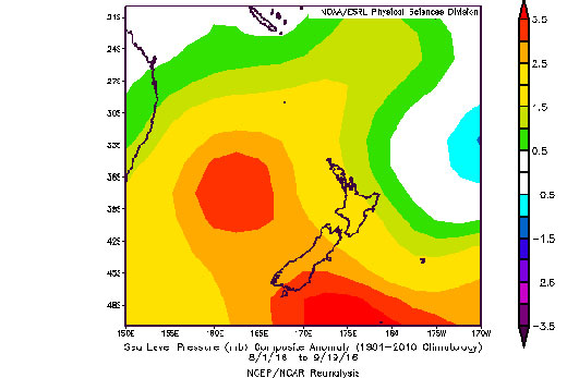
This map shows how unusual the start to spring has been.
The colours show pressure anomaly, or the difference between this year's average August and September surface pressure and the long-term average.
The image shows high pressure (red colours), to the south and west of the country whereas typically this would be expected over the north of New Zealand. Data courtesy of NOAA. 'With the spring equinox coming up on Friday, this is not the typical set-up we'd expect to see,” says meteorologist Tom Adams.
'This time of year we normally see high pressure north of the country and strong westerlies, but what we are currently experiencing is the reverse of that. Although the regular pattern should assert itself at some point, the odds are against that happening in the next few weeks.”

0 comments
Leave a Comment
You must be logged in to make a comment.