


Communities around Whitianga, up the coast and through to Coromandel and Colville are being advised to stay vigilant with flooding, slips and road closures a real possibility today.
Earlier the MetService issued a severe weather warning for the peninsula, with periods of heavy rain expected to batter the Coromandel through much of today and into Thursday morning.
The MetService and Thames-Coromandel District Council are asking locals to watch out for potential flooding and slips around the peninsula today. File Photo.
A low just north of New Zealand remains slow-moving though to Thursday morning, while an associated front currently lies over northern Auckland and is expected to move slowly south today, before weakening over the Coromandel on Thursday.
'In the 18 hours from 9am Wednesday to 3am Thursday, expect another 80 to 120mm [of rain] to accumulate on top of what has already fallen, especially in the north,” says the MetService.
'Peak intensities may reach 25 to 35mm per hour, and thunderstorms are possible.”
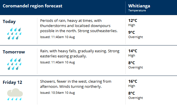
Image: MetService.
Both the MetService and the Thames-Coromandel District Council advises locals to look out for rapidly rising rivers and streams, slips and surface flooding.
Council says at Port Jackson the Muriwai Stream ford is currently impassable with a lot of surface flooding in the area, while the Pahi Stream ford is flooded with 15cm of water.
A small slip is also blocking one lane on the Whitianga side of The 309 Road, but is still passable.
Locals are being asked to avoid travel unless it's necessary, especially in the northern Coromandel area. Farmers may also want to consider moving stock, while boat owners should ensure their vessels' moorings as well as ensure they are tied up securely.
The Thames-Coromandel District Council will be providing regular weather updates on its Facebook page at www.facebook.com/ThamesCoromandelDistrictCouncil

0 comments
Leave a Comment
You must be logged in to make a comment.