


The ridge of high pressure that has brought sunny skies to many parts of the country over the past couple of days is beginning to slip away, as we head towards the weekend.
Strong northwesterlies are expected to develop for eastern parts of the South Island and the lower North Island on Saturday, ahead of a front expected to move up the country during the weekend.
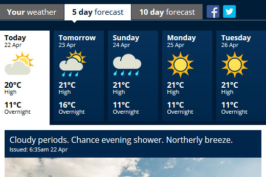
Tomorrow and Sunday are looking a bit wet, but the MetService is predicting fine skies on Monday. Image: MetService.
The weather should then settle down again for most people for ANZAC Day.
'The weather will start to deteriorate for the west and south of the South Island during the second half of Friday,” says MetService Meteorologist Claire Flynn.
'Rain will then spread northwards during Saturday, with some heavy falls in the west. Rain will reach the lower North Island later that night, however some places will see some showers before the front reaches them.”
The front is then expected to move over the North Island on Sunday.
Behind the front, a cool southwest flow is expected to bring sunshine to many for ANZAC Day.
Those in Northland and also Gisborne and Hawke's Bay will not be so lucky, with a few showers remaining throughout the day.
The south and west of the South Island will also see showers, though these should gradually clear during the day apart from a few lingering about the south coast and coastal Buller.

0 comments
Leave a Comment
You must be logged in to make a comment.