


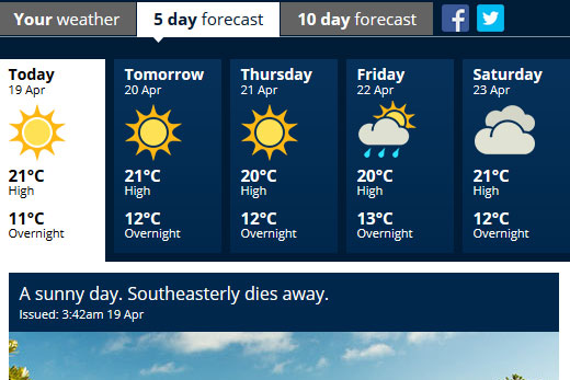
High pressure will dominate the first week of the school holidays, bringing long periods of sunshine to most places.
However, a front is expected to spread over New Zealand in the weekend.
The MetService is forecasting a fine week in the region.
'A high is building over the country today and will remain in place until late this week. There are still likely to be one or two showers, mainly about the northern and southern extremities of New Zealand, but most places will get plenty of sunshine this week,” says MetService meteorologist Stephen Glassey.
The sunnier weather will come as a change to what many people experienced on the weekend.
A low pressure system tracked southeast over the upper North Island on Saturday and Sunday, bringing downpours to some places, before moving away to the east of the country today.
Whitianga recorded 124mm on Sunday, while parts of Northland, Auckland, Bay of Plenty, and Gisborne also received heavy rain as the system moved through.
A weakening front also brought cloud and rain to parts of the South Island.
The high pressure is expected to weaken on Friday, allowing a front to spread north over New Zealand during Anzac Weekend.
'This front is likely to bring a period of rain as it spreads north, followed by colder temperatures, but the weather should clear most places in time for ANZAC Day,” says Stephen.
Away from New Zealand, a tropical depression near Fiji is being monitored closely for signs of development into a tropical cyclone.
The latest Tropical Cyclone Potential bulletin and satellite imagery from the tropics can be found on our website at http://info.metraweather.com/e/60812/ings-tropical-cyclone-activity/8d44k1/324426378

0 comments
Leave a Comment
You must be logged in to make a comment.