


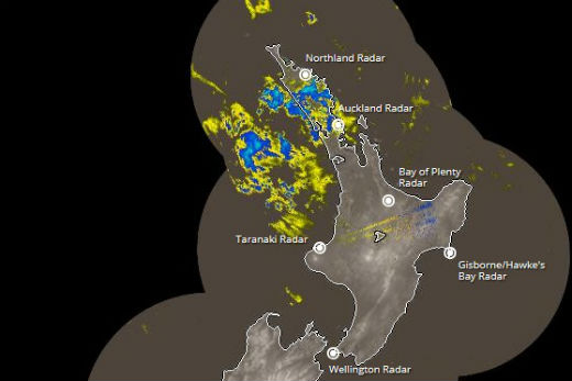
The MetService have issued a severe weather watch for Coromandel Peninsula, Rotorua and Bay of Plenty today.
A moist, sub-tropical airmass covers the North Island, bringing bursts of heavy rain or showers to northern New Zealand.
Further south, a cold front followed by a strong cold southwest change is expected to reach the lower South Island tonight, then move quickly northwards during Monday.
The MetService says there is a possibility of 'heavy rain” approaching warning criteria in the following areas; Auckland, Waikato, Waitomo, Taumarunui, Tongariro National Park, Taupo, Coromandel Peninsula, Rotorua and Bay of Plenty.
Although widespread heavy rain looks less likely for much of today, there remains a risk of scattered heavy showers with localised downpours this afternoon and evening, where rainfall rates could briefly reach 25 to 40mm per hour.
This evening, a more organised band of rain is expected to move in from the west, bringing a risk of heavy rain to Waitomo and Taumarunui.
During Monday morning the area of potential heavy rain spreads into Waikato, Tongariro National Park, Taupo, Rotorua and Bay of Plenty, then into Auckland and Coromandel Peninsula by Monday evening.
This band is likely to bring short periods of heavy rain, where accumulations could reach warning criteria (50mm in 6 hours or 70mm in 12 hours).

2 comments
really?!
Posted on 28-02-2016 15:38 | By Captain Sensible
Going by their previous results, I can't help but think they will likely be wrong...again.
another rain warning
Posted on 29-02-2016 07:39 | By Captain Sensible
really?
Leave a Comment
You must be logged in to make a comment.