


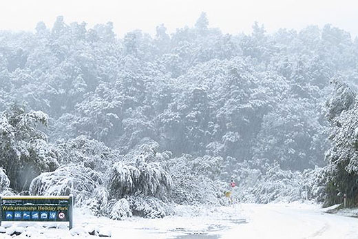
The blast of Antarctic air which has blown over New Zealand is expected to ease tomorrow.
A ridge of high pressure is going to move over from the Tasman Sea, bringing drier and sunnier conditions.
Snow fell in the Eastern and Western Bay of Plenty this week. This picture show the heavy snow fall at Waikaremoana Holiday Park yesterday.
The light winds and clear skies overnight however will lead to cold mornings right across New Zealand. "The South Island escapes the punishing southerlies first as the ridge creeps over Southland and Otago from late Thursday,” says MetService meteorologist Rob Kerr.
'The rest of the South Island is under the ridge by late Friday and the whole country during Saturday,” says Rob.
Relief from the showers and wind will not bring respite from the cold temperatures though, with single digit highs expected for most of central and southern New Zealand right through the weekend.
'Despite a return to some winter sunshine in many central and eastern places, extreme frosts are likely around inland South Island areas, with frosty starts possible in most places right through the weekend,” warns Rob. With the winds settling down and plenty of fresh snow about, conditions on the ski fields of both Islands look set to be excellent this weekend.
However, driving could continue to be dangerous with icy conditions lingering in some spots over the coming days. Motorists can check the status of roads via NZTA at: http://www.nzta.govt.nz/traffic/

0 comments
Leave a Comment
You must be logged in to make a comment.