


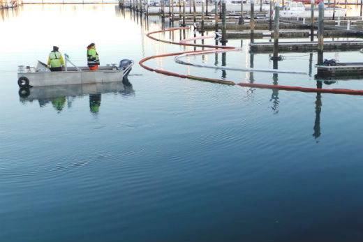
Envirowaste contractors were on the job in the chilly dawn today cleaning remnant oil pockets out of the Bridge Marina pontoons.
Contractors were using a boat's propeller wash to clear the oiled weed from between the pontoon floats, with the debris being collected with booms and nets.
Contractors are messing about in boats in three degree temperatures.
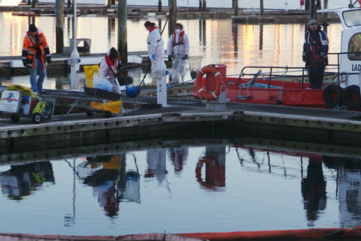
Despite low temperatures, the early start is to take advantage of the early incoming tide.
The air temperature at the Bridge Marina crept up to 3.3 degrees after daybreak from an overnight low of 2.3 degrees at Tauranga Airport.
It was colder at Whakatane airport overnight at -1, and -2 in Kawerau.
Today's expected high in Tauranga is 12 degrees. Almost tropical compared with the overnight low of -19.8 at Pukaki aerodrome near Twizel.
'It's cold right across NZ at the moment,” says MetService meteorologist Stephen Glassey. 'Temperatures in the bop have dropped below zero in some places.
'It's going to be fairly similar tonight. It's a pretty similar weather situation last night as it is tonight. In really sheltered spots there could be a frost. You really need light winds to help with the frost.”
It's going to be a fine day for the Bay of Plenty today, and it's looking fairly settled for the next few days, says Stephen.
The forecast is for a ridge of high pressure lying across the South Island during Wednesday and Thursday to continue to bring severe frosts to many places.
A deep low east of the North Island on Wednesday will maintain strong cold southerlies across the east and south of the North Island and snow showers for the ranges.
There is low confidence of southerly gales becoming severe about Gisborne and eastern Bay of Plenty during Wednesday and early Thursday.
The deep low is also likely to produce heavy southeast swell affecting the coastlines of Gisborne and Hawke's Bay during Wednesday, Thursday and Friday.
The heavy swell is expected to peak during Thursday, possibly reaching six to eight metres in parts of coastal Gisborne, before the low moves away to the east of the North Island on Friday.
On Friday, a trough moves across the South Island, bringing a burst of heavy rain to the west of the South Island, with low confidence of rainfall amounts reaching warning criteria in Fiordland.
The trough clears the North Island early Saturday and is followed by a disturbed showery southwest flow.

0 comments
Leave a Comment
You must be logged in to make a comment.