


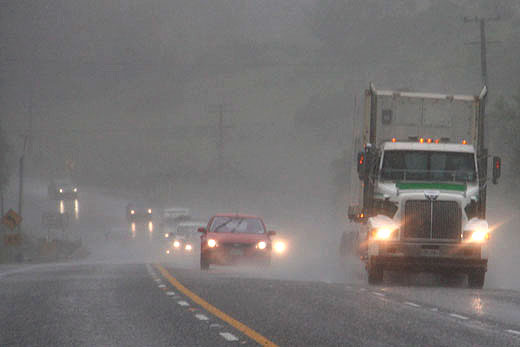
Heavy rain is being predicted for the Bay of Plenty this weekend with a severe weather warning in place for the region.
The MetService issued the warning this morning as a strong, moist northwesterly flow with embedded fronts is expected to affect the North Island tomorrow.
Periods of heavy rain are forecast for the Bay of Plenty this weekend.
Heavy rain is expected in the central North Island high country, the eastern ranges of the Bay of Plenty and the ranges of Gisborne.
'Rain is expected to become heavy Saturday morning. In the 18 hours from 6am to midnight Saturday expect 120 to 180mm of rain about the ranges,” says a statement from the MetService.
'Peak inensities of 15 to 25mm per hour Saturday afternoon.”
Temperatures in the region are expected to sit around the 16-18 degree mark for the next two days before dropping to around 12-13 degrees on Monday and Tuesday.
Additionally, parts of Taranaki and the central Plateau are set to receive more rain on Friday and into Saturday with snow likely to return to the Desert road and the Volcanoes.
Rain is forecast to continue to track northwards during Saturday accompanied by strong and gusty northwesterly winds.
Areas from Waikato to Northland and the Bay of Plenty are likely to catch the final throws of the storm on Saturday as it moves northwards.
After a wet Saturday in Auckland the weather is set to improve for Sunday, but still a few showers are left to clear.
Although there has been plenty of talk of cold weather over the last few days, the temperatures across the eastern parts of the North Island are likely to remain very mild for this time of the year.
For Napier and Hastings temperatures are set to climb up into the high teens and even reach 20C on Saturday.
"The start of next week sees the cold weather push right across the country and temperatures across much of New Zealand will really struggle during the first few nights of next week," says MetService meteorologist John Law.
The return of cold air plus a building high pressure is set to bring widespread frosts across both the North and South Island.
"At this stage, temperatures about central and eastern parts of the South Island for Tuesday morning look to drop well below freezing, with severe frosts forecast in places," Law adds.

0 comments
Leave a Comment
You must be logged in to make a comment.