


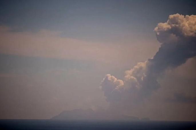
Whakaari/White Island continues to erupt intermittently more than a year after a new phase of volcanic activity began.
Scientists are monitoring ongoing ash emissions and unrest off the Bay of Plenty coast.
In a post on its website, GeoNet said the current eruptive episode started in May 2024 and has since been marked by elevated activity, including a series of weak eruptions and intermittent ash emissions.
Whakaari, located about 50km offshore from Whakatāne, is New Zealand’s most active volcano and has cycled through eruptive phases for decades.
Rather than isolated eruptions, scientists said the volcano typically experiences clusters of activity driven by processes beneath the surface.
The latest episode is linked to magma moving closer to the surface, increasing heat and gas output and triggering small eruptions. Similar processes were behind previous eruptive periods in 2012-2013, 2016 and 2019.
Monitoring scientists have kept the volcanic alert level between Level 2 and Level 3 during the latest activity. Level 2 indicates moderate to heightened unrest, while Level 3 reflects a minor volcanic eruption.

Volcanic activity at Whakaari/White Island since January 2024 showing volcanic alert level, ash or steam eruptions, and ash emission phases.
Because of limited real-time monitoring equipment on the island, scientists say they are unable to reliably distinguish lower levels of activity, meaning the alert level has been set at a minimum of Level 2 until systems are fully restored.
Despite visible ash emissions during some eruptions, there have been no significant impacts recorded on the mainland.
The ash produced is typically fine and carried away by the wind, remaining airborne rather than settling. Larger ash particles tend to fall closer to the volcano itself.
However, volcanic ash has at times affected airspace, with some disruption to flights in the region.
GeoNet said it works closely with aviation authorities, MetService’s volcanic ash advisory centre, and maritime officials to manage risks to aircraft and vessels.
For Bay of Plenty residents, activity at Whakaari is often visible on clear days, with steam and gas plumes rising above the island. Darker plumes can signal ash emissions, occasionally visible drifting downwind.
GeoNet said these plumes can appear more prominent under certain weather conditions, particularly on cold, clear days.
Beneath the volcano lies a complex magma system, with molten rock stored 5-7km below the surface. When magma rises to shallower depths, less than 1km underground, it increases gas and heat output, driving the activity seen at the surface.

A simplified model of what’s below Whakaari/White Island volcano. Magma moves from deep (1) to shallower levels (2), and then gas, heat and ash pass through the hydrothermal system (3) and vents (4) and form a plume above the volcano (5).
Scientists monitor these changes using aircraft-based gas measurements, thermal imaging and satellite observations, regularly updating the public through volcanic activity bulletins.
Historical records and geological data suggest Whakaari is a persistently active volcano, with most eruptions remaining small and largely confined to the island and surrounding waters.
Based on past behaviour and current monitoring, scientists say the volcano is likely to continue producing this level of activity in the foreseeable future.

0 comments
Leave a Comment
You must be logged in to make a comment.