Monday was cold for many regions with single digit highs. Tuesday morning saw some heavy frosts. Now Wednesday looks warmer than average while Thursday looks warmer still.
The ups and downs are due to changing wind directions and air flows caused by the chaos of spring, says WeatherWatch.co.nz
The reason it's warming up is because the westerly quarter winds are now returning - much warmer than the S to SE winds many places had over Sunday, Monday and Tuesday, which came right out of the Southern Ocean.
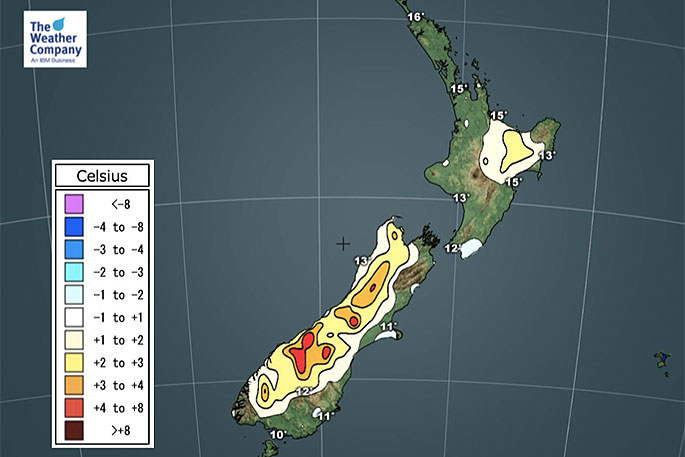
 Maximum temperature departure from normal on Wednesday.
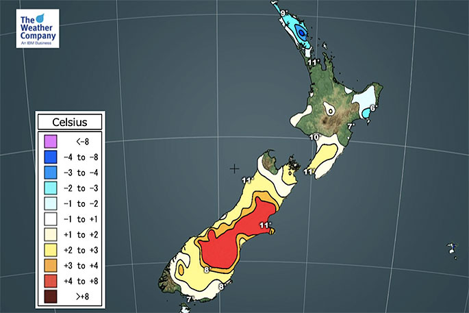
"On Thursday these west to north west winds (more so from Aussie) ramp up even more, especially over the South Island, pushing temperatures up above normal for this time of year.
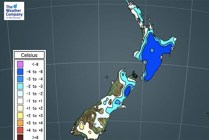
"But tonight will be colder than normal for much of the North Island and upper South Island before those winds arrive - but tomorrow night looks warmer than average for many parts of the South Island due to those winds (cooler and calmer over the North Island though).
"NZ does have a cooler change around Friday and Saturday but by early next week those warmer westerlies should return again for Monday and Tuesday."
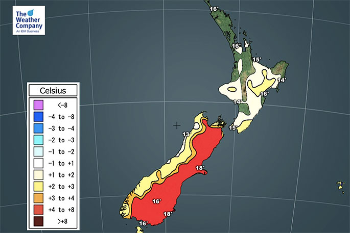 Maximum temperature departure from normal on Thursday.

0 comments
Leave a Comment
You must be logged in to make a comment.