Most of the North Island and the top of the South are cloaked under weather alerts, impacting major holiday and festival hotspots.
Rain has already begun falling in Gisborne and the Coromandel, which are both under heavy rain warnings until at least tomorrow morning.
Up to 21 hours of rain is due to fall over Gisborne with a threat of flooding, slips and difficult driving conditions.
Heavy rain is forecast through Hawke’s Bay from later this morning, forecasters say, potentially disrupting plans for those travelling in and out of the region ahead of New Year’s Eve.
Potentially damaging gales are set to whip through central New Zealand and its western coastline, with Wellington, Manawatū, Horowhenua and the Kāpiti Coast expecting severe southeasterly gales from 4pm until 9am tomorrow.
In over a dozen other regions, from Buller to Waikato, winds potentially reaching gale-force in exposed places are forecast.
MetService described conditions for today and tomorrow as “wet and wild” with heavy rain and gale southeasterlies.
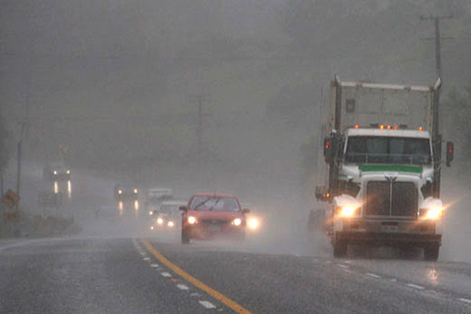
 'Wet and wild' conditions have been forecast for the North Island's east coast today and tomorrow. Photo / Windy.com
Forecaster Samkelo Magwala told the Herald a low pressure system was heading towards New Zealand and was forecast to hit today.
“We are expecting it to result in windy conditions and widespread rain, which might be heavy in some places,” he said.
MetService has issued a series of warnings for the eastern side of the North Island until late this evening and early tomorrow.
A heavy rain watch is currently in place for the Coromandel Peninsula until 7pm with 90 to 130 mm of rain expected today.
“Peak rates of 15 to 25 mm/h expected from late Monday morning,” MetService said.
Heavy rain warnings are forecast to begin from this morning until early tomorrow morning for Gisborne/Tairāwhiti and Hawke’s Bay.
Between 90 and 130mm of rain is forecast for both regions during the affected period; however, 150 to 200mm is forecast for north of Tolaga Bay.
“Severe gale southeast winds gusting 120 km/h in exposed places,” MetService said.
“Damage to trees, powerlines, and unsecured structures [is] possible. Driving may be difficult, especially for high-sided vehicles and motorcycles.”
Strong wind watches are also forecast to begin this morning for Auckland, Great Barrier Island and Coromandel Peninsula, and Waikato, Waitomo, Taranaki, Taumarunui, Taupō, Tongariro National Park and Taihape.
A heavy rain watch is also forecast to begin this morning for Bay of Plenty, including Rotorua.
Magwala said, even though the current weather would move off the country tomorrow, another system would move in later.
“[It] will give some widespread rain. The rain will be with us for a bit longer.”
Magwala said the extreme weather would make for bad driving conditions.
“Depending on where you are and what time you are planning your trip, because it is going to be bad in the central and eastern parts of the North Island.
“Unfortunately, rain is on the cards for those going to music festivals in the Hawke’s Bay.”

0 comments
Leave a Comment
You must be logged in to make a comment.