


New Zealand is now under the influence of a large high pressure system coming in from the Tasman Sea.
Dry weather will persist for a few days ahead over most areas, before a sharp cold front brings widespread rough winter weather from Saturday night and across Sunday.
Some light coastal showers will persist in both islands, says WeatherWatch.co.nz
"Thursday will then be sunny in Wellington, Christchurch, and most areas in the South Island except Southland once again.
"Cloud cover will increase in Taranaki, Waikato, Auckland and Northland from Thursday morning as winds shift just a little."
Due to the recent cold southerlies and now clear skies (especially inland) minimum temperatures during nighttime will be lower than normal for next few days, especially in the North Island and upper South Island.
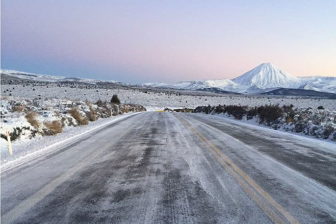
SH1 RANGIPO TO WAIOURU (DESERT ROAD) - SNOW AND ICE - 1:10PM UPDATE
— NZTA Central Nth Is (@NZTACNI) June 27, 2018
The road is now OPEN. Please remember to drive to the conditions. This image was taken earlier by Downer Waikato. ^RS pic.twitter.com/I0SyOKUs4m
"Sub-zero minimum temperatures are possible in wide areas over interior North Island, rising the risk of frost," says the weather organisation.
"Coastal areas have more of a breeze and clouds which may keep temperatures above zero for the most part."
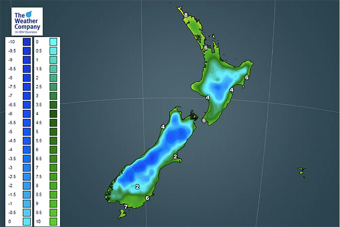 Forecast temperatures for tonight.

0 comments
Leave a Comment
You must be logged in to make a comment.