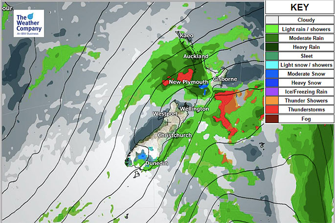
The first of two significant cold fronts is crossing the country and will this afternoon clear the North Island as the next cold front arrives in the Deep South.
This secondary burst of cold air coming tonight and across Tuesday will be the coldest surge of air for many places with showers, some heavy with isolated hail and thunder and snow on the ranges.
WeatherWatch.co.nz head forecaster Philip Duncan says winds on Tuesday from the south to south west will be cold nationwide and may even reach gale force around Auckland and other marine areas for a time.
"For Monday showers will occur over the North Island and the western side of the South Island. There will be a period of rain about 10mm/h with strong wind gusts later tonight in the South Island and across Tuesday daytime in the North Island, as the secondary cold front forms and moves northward."
A burst of heavy snow will occur in Southland and parts of Otago during early tonight. Snow accumulation over 5cm is expected over mountain areas and motorists should take extreme care and avoid driving tonight if possible with possible road closure.
"There may be also some snow accumulation over plains too although totals won't be high".
There may be some snow on SH1 the Desert Road and also SH5 the Napier-Taupo highway on Tuesday.

0 comments
Leave a Comment
You must be logged in to make a comment.