


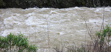
Environment Waikato is warning of more potential for flooding as forecast heavy rain threatens to place significant pressure on already swollen rivers and saturated catchments in the region.
A forecast for Mt Taranaki and hill country extending into southern Waikato and Tongariro National Park says that in the 21-24 hours from 6am Thursday, 150-200mm of rain will fall on Mt Taranaki's upper slopes, while 70-100mm will fall on the lower slopes and the hill country further inland.
"The 70mm to 100mm rainfall predicted for parts of our region, if it eventuates, could result in higher Waikato and Waipa river levels than we saw last week, meaning potential for flooding beside waterways," says EW emergency management officer Adam Munro.
"We are urging the general public and farmers to stay on the alert for information and be prepared to take action required to protect people, stock and property.
"Lake Taupo's level, which has been falling, will also rise again if we get the forecast rainfall. That means we will have to continue working closely with Mighty River Power to return it to well below 375.25 metres above sea level, which is the top of its consented operating range."
Mr Munro said EW would also liaise closely with emergency services and Civil Defence about where river levels are tracking and what threat they might present.

0 comments
Leave a Comment
You must be logged in to make a comment.