


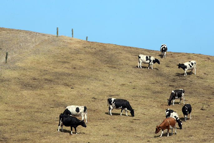
One of the “strongest” El Nino events on record could be heading New Zealand’s way, bringing a hotter, windier and drier spring for the Bay of Plenty.
Forecasters say strong westerly winds, reduced rainfall and periods of unusually “spiky” temperatures are likely as the “climate driver” strengthens in the months ahead.
Earth Sciences New Zealand principal scientist Chris Brandolino said forecasts for the Bay of Plenty pointed to stronger westerly winds from spring onward.
“It’s looking like it could be a particularly windy spring, which inherently spring is windy anyway, but this could be something even more so.”
Those winds, blowing from the northwest and southwest, typically bring drier conditions to the region and tilt the odds towards below-normal rainfall, Brandolino said.
“Reduced rainfall doesn’t mean zero rain, it just means less than what is typical for that time of year.
“There tend to be outcomes that favour rainfall being lower than normal for the Bay of Plenty, but these things aren’t guarantees.”
The forecast also raises the possibility of short bursts of unusually warm weather, particularly when northwesterly winds come down from the Kaimai Range.
Brandolino said these were “spiky temperatures” that could climb well above normal for several days at a time before cooling again.
“You might get a period in late September or October where people think, ‘Wow, it’s really warm for the time of year’.”
While the exact local impacts remain uncertain, Brandolino said confidence was growing that the developing El Nino could rank among the strongest recorded.
“This event will rank up there with the most intense of all time,” he said.
“It’ll be somewhere in the top-five strongest El Ninos, and there’s a pretty good chance it could be the strongest in modern history.”
He said El Nino was a “climate driver” that influenced weather patterns over months rather than a single storm event, with its effects gradually filtering through to local conditions.

Earth Sciences New Zealand principal scientist Chris Brandolino. Photo / Earth Sciences NZ
“It’s basically who’s driving Mother Nature’s car? Who has their hands on Mother Nature’s steering wheel?”
MetService meteorologist Braydon White also said El Nino would bring winds and weather systems from the west.
“They then drop their rain in western areas, whereas eastern areas like the Bay of Plenty are sheltered and so see drier conditions.”
He said there were “concerns” this could lead to an increasing risk of drought and wildfires.
“The increased westerlies alongside drier conditions will lead to drier vegetation and fuel for the fires.
“Then on windy and warm days with low relative humidity, all it would take is a spark to potentially start a wildfire.”
He said communities should listen to advice from Fire and Emergency New Zealand on preparing themselves for later this year.
“Even small things like putting away outdoor furniture covers or ensuring gutters and decks are clear of dead plant material can help protect your home if a fire does start.”
Sectors impacted by El Nino
The combination of stronger winds, lower rainfall and warm spells could place pressure on water-reliant sectors, including horticulture and farming.
Experts have urged farmers, growers and households to start considering contingency plans should dry conditions develop later in the year.
New Zealand Kiwifruit Growers Incorporated (NZKGI) head of communications and strategic projects Mike Murphy said dry or unpredictable weather, with increasing water restrictions, could pose a risk to orchard productivity.
“Access to water, including water storage, is a critical consideration for growers when making orchard management decisions, particularly in relation to irrigation and frost protection.”
He said kiwifruit vines were “highly dependent” on a reliable water supply.

Dry or unpredictable weather, with increasing water restrictions, can pose a risk to orchard productivity. Photo / Kelly O'Hara
“If vines experience water stress, particularly during periods of rapid growth, they can wilt, and their leaves can quickly turn brown.”
Murphy said dry conditions could result in smaller fruit, and prolonged or severe water shortages might reduce yields in seasons to come.
“Ensuring sufficient access to water is therefore essential for producing a profitable crop and maintaining orchard visibility.”
Bay of Plenty Federated Farmers president Brent Mountfort said farmers were no strangers to El Nino events, having dealt with them for many years.
“We do know that if there’s an extreme one potentially, it’s going to give us dry conditions.”
Mountfort said past El Nino events had changed the way farmers managed drought risk.
“They’re definitely better prepared, we understand that our climate seems to have changed and so therefore our extremes seem to be heavier rain and when the spells are dry, they can potentially be a lot hotter and drier.”
He said farmers prepared by reducing stock numbers where possible, checking water systems were working properly and ensuring animals had access to adequate shade.
“Moisture levels right now are very high in a lot of our areas, so at the moment, we’re not going into this El Nino with a deficit, and that will help a bit.”

2 comments
chris
Posted on 14-07-2026 14:49 | By terminal
and???? so we will learn to adapt and run with it.. as always
el neeee no
Posted on 15-07-2026 10:46 | By terminal
one word that shows it all COULD they dont know they are just covering there buts lets put the frighteners up them that will show we are doing our job yeh right
Leave a Comment
You must be logged in to make a comment.