


Events are being cancelled, cruise ships are being diverted and forests may be closed in the Bay of Plenty in preparation for Cyclone Vaianu making landfall this weekend.
The exact trajectory of the cyclone is yet to be confirmed, and authorities are warning people not to be complacent as the Category 2 storm bears down.
Weather warnings
Vaianu is set to bring severe weather to much of the North Island this weekend, with heavy rain and damaging winds for the Bay of Plenty, including Rotorua, from early Sunday.
A yellow rain watch and a yellow wind watch have been upgraded to an orange rain warning and an orange wind warning.
The orange rain warning is in place for the Coromandel Peninsula and areas of the Bay of Plenty west of Whakatāne, including Rotorua.
A rare red alert for severe wind is in place for Coromandel from 5am to 6pm on Sunday, with gusts expected to hit 140km/h.
Between 2am to 4pm on Sunday, forecasters predict 150 to 180mm of rain, particularly over the ranges.
Peak rainfall intensities of 20 to 30mm an hour are expected on Sunday morning and early afternoon.
There is a moderate chance the warning could be upgraded to red.
A strong orange wind warning is in place for Bay of Plenty and Rotorua from 4am to 7pm on Sunday.
Severe gale easterlies are expected to develop before shifting to severe gale westerlies later in the afternoon.
Gusts up to 130km/h are possible in exposed areas, and forecasters say there is a high likelihood the warning could escalate to red.
Strong winds are likely to damage trees, powerlines and roofs, disrupting transport and possibly causing power outages. Driving conditions are expected to be dangerous, particularly for high-sided vehicles and motorcyclists.
The National Emergency Management Agency is advising people to clear drains and gutters before the rain, secure loose outdoor items, avoid low‑lying areas and unnecessary travel, and prepare for potential power cuts.
The next weather update is due at 9pm on Friday.
 The latest track of Cyclone Vaianu shows it bearing down on New Zealand. Image / Joint Typhoon Warning Center
MetService forecaster Heather Keats told Ryan Bridge TODAY there’s now more clarity on the path of the “very large, damaging weather system”.
“It’s expected to cross over the top of the Coromandel Peninsula, move over Bay of Plenty, come across Hawke’s Bay and flick out to the east.
“Winds will be the biggest impact from the storm – it’s very fast – so it’ll race across on Sunday, but the worst weather will be felt on either side of the eye of the storm and last about 36 to 48 hours.”
Emergency hubs to open
Community emergency hubs will open across the Western Bay of Plenty District from 8am on Sunday for the day, with marae also preparing to support displaced people.
The Western Bay of Plenty District Council said people could ride out the storm in those places if they felt unsafe at home because of due to flooding, slips, power outages or other cyclone impacts.
People should bring food and water, medication, warm clothing and essential personal items.
The hubs were not set up for overnight stays, and people were encouraged to ask friends or whānau first.
Community emergency hub locations
- Waihī Beach RSA, 99 Beach Rd
- Katikati Baptist Church, 2 Wedgewood St
- Pukehina Community Hall, 16 Pukehina Parade
- Te Puke War Memorial Hall, 130 Jellicoe St
- Ōmokoroa PavilionPavillion, 28 Western Ave
- The MGC in Maketū, Arawa Ave.
Marae
- Tuapiro Marae, Hikurangi Rd, Katikati (open from 4pm on Saturday)
- Paparoa Marae, Borell Rd, Te Puna (will open if needed)
- Whetu Marae, Welcome Bay Rd (will open if needed)
- Makahae Marae, Te Kaika Rd West, Te Puke (will open if needed)
- Pukehina Marae, 2655 State Highway 2, Pukehina (will open if needed)
Council emergency management controller Peter Watson said if Cyclone Vaianu passed over the district, there would be flooding and likely power outages, downed trees, slips and road closures.
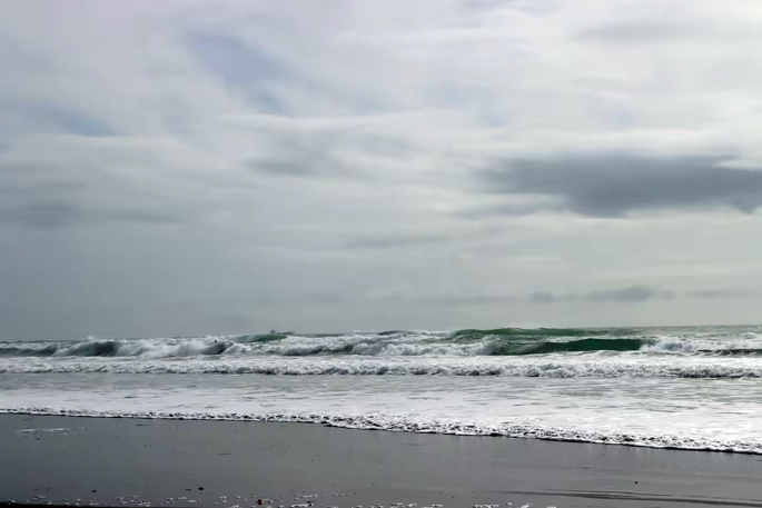
Forecasts predicted coastal swells of 7m-plus for Waihī Beach and Pukehina, damaging winds, intense rainfall on already saturated land, and coastal inundation, particularly around high tide.
He encouraged coastal residents, especially in Waihī Beach, Pukehina and Maketū, to consider their weekend plans.
“If you live right along the coastline and don’t need to be there, it may be safer to make alternative arrangements with friends or whānau,” Watson said.
He also urged people to stay clear of beaches and coastal areas as conditions would be dangerous.
He said the system was fast-moving but forecast to deliver a “short but potentially devastating burst of weather”, so people were urged to prepare.
Watson said teams were checking known trouble spots, monitoring waterways, and reviewing stormwater and roading networks.
The council would activate its Emergency Operations Centre if conditions escalated.
Issues such as slips, downed trees and power lines, flooding or blocked drains could be reported to the council on 0800 926 732 or via the Antenno app.
Updates would be posted on the council’s Cyclone Vaianu Weather Event Hub, Facebook page and Antenno.
Parks and facilities in Tauranga
All Tauranga City Council public-facing facilities will be closed on Sunday, a council statement said.
These include libraries, Baycourt, the Cargo Shed, the Historic Village and Te Maunga transfer station.
All facilities operated by Bay Venues will also close on Sunday, including all pools, indoor court venues, community centres, halls, Clubfit gyms, Mercury Baypark, UoW Haumaru Sport & Recreation Centre and Queen Elizabeth Youth Centre.
All council parks and reserves with lockable gates will be closed to the public from Saturday afternoon until Monday morning.
- Arataki Park
- Beach Rd Reserve
- Cambridge Park
- Carlton St Reserve
- Fergusson Park
- Gate Pā Domain (Recreation)
- Gordon Carmichael Reserve
- Gordon Spratt Reserve
- Greerton Park
- Hewletts Rd Reserve
- Kopurererua Valley
- Kulim Park
- Links Ave Reserve
- Marine Park
- Matua Saltmarsh
- Mitchell Park
- Oceanbeach Rd Reserve
- Omanu Beach Reserve
- Opupu – Rotary Park
- Otumoetai Railway Reserve
- Pāpāmoa Beach Reserve 1
- Pāpāmoa Domain
- Pemberton Park
- Rowesdale Drive Reserve
- Selwyn Park
- Tutarawananga – Yatton Park
- Tye Park
- Waipuna Park
Most public toilets and changing facilities outside these gated parks will remain open.
Sandbags
For flood-prone properties, the council said, sandbags could be organised through local hardware or garden supply stores.
These were not waterproof and were unlikely to stop water from entering a home, but could help redirect it.water.
“Please note: there is a bylaw that prohibits the removal of sand from our beaches and foreshores.”
Surf conditions
NextSurf app founder and developer David Quinlan, who has surfed the Bay of Plenty coastline for 12 years, said he noticed the energy in the water starting to build on Thursday night.
Quinlan said he thought the swell was likely to force the closure of all Bay of Plenty beaches when it peaked around midday on Sunday.
“Yeah, for surfwise, we’re kind of looking on either side of that, so from this afternoon until tomorrow midday should be okay for surf.
“Then it’s going to get a little bit out of control for the next sort of 24 hours.”
Quinlan said the swell was not suitable for beginners, and even experienced surfers were likely to struggle.
The waves would demand strong fitness and confident paddling, with red flags expected along the entire coastline.
“Stay out. Wait until Monday or Tuesday. It’s not the place for an inexperienced surfer this weekend.”
The Bay of Plenty Times spoke to Charlie Rapson on Friday morning, who said he had been enjoying the swell so far.
“It’s been good the last couple of days, but it’s starting to change. The wind is coming through a bit today.”
Another surfer described the conditions as scary; he said getting out at the back of the waves was difficult.
“I don’t surf a lot, and with a new board it’s definitely more challenging than I’m used to.”
Surf Life Saving NZ eastern region manager Chaz Gibbons‑Campbell said the incoming swell would create hazardous conditions across the region.
“It’s going to be pretty wild out there.”
He said the swell was expected to build from Saturday afternoon into Sunday, reaching around 3m and pushing a large volume of water along the coastline.
 Surfers take advantage of calmer conditions before the swell intensifies. Photo / Zoe Blake
Gibbons‑Campbell warned that lifeguards were unlikely to be able to respond safely if anyone got into difficulty in the water.
He urged sightseers to stay clear of the shoreline, with storm surge expected to push waves right up to the dunes.
“There’ll be nowhere to run if you get caught out.”
His key message was to stay off the beach and out of the water for the next 48–72 hours.
“It’s not the time to test a new board or go thrill‑seeking. It’s going to be dangerous.”
Event cancellations
The Ultimate Athlete event in Mount Maunganui this weekend has been postponed.
In a Facebook post, organisers say that as Cyclone Vaianu moves through, forecasts show significant swell building from Saturday.
“The predicted swell surges on Mount Maunganui beach make it unsafe for event infrastructure; the event can’t go ahead this weekend.
“We’ve made the call now to try to give everyone as much notice as we can – whether you’re travelling, planning, or getting ready to race.”
Organisers expect to confirm a new date soon.
Cruise ships
The Discovery Princess cruise ship, which departed from Sydney on Tuesday for the final New Zealand cruise in its maiden Australian season, has decided to dock in Auckland tomorrow instead of visiting Tauranga, because of the cyclone.
A spokesperson said docking in Tauranga first could have affected the ship’s planned arrival in Auckland on Sunday, when bad weather is expected to be at its worst.
Its scheduled departure from Auckland to the Bay of Islands on Monday may also be cancelled “depending on what the storm does”.
 The Discovery Princess during her maiden call to Tauranga in 2025.
“Discovery Princess is going to spend two days in Auckland to ride out the storm. The Port of Auckland tugs could be busy looking after her!“
Another cruise ship, the Norwegian Spirit, has also adjusted its schedule to avoid the Bay of Islands and Tauranga, instead travelling south, where it will dock in Wellington on Sunday morning.
The Discovery Princess is subsequently relocating across the Pacific to Vancouver, where it will be used to operate Alaska cruises over the northern summer season.
Potential forest closures
Rotorua Lakes Council teams and contractors are in full preparation mode as they monitor the potential impact of Cyclone Vaianu on the district.
“One of our key concerns is the impact of isolated or localised downpours in specific catchments. One area may see very little rain, while another experiences flooding and inundation.”
If winds of more than 60km/h are forecast, the council may need to close Whakarewarewa Forest to recreational activity for safety reasons.
 If winds of more than 60km/h are forecast, Whakarewarewa Forest may be closed to recreational activity for safety reasons.
A final decision will be made after the latest forecasts are reviewed on Saturday evening, with updates shared via council channels and forest-related platforms, including the Rotorua Trails Trust.
If a closure occurs, gates at key access points will be locked, signage will be installed across access areas and the Scion dog park will also be closed.
The public is urged not to ignore any closures, because there would be a high risk of falling trees, slips and debris.
Businesses operating in and around the forest have been advised of the potential closure, and any operations within closed areas would also be required to shut.
Meanwhile, State Highway 2 through the Waioweka Gorge is open this morning after material from yesterday’s slip was cleared.
NZ Transport Agency said motorists should allow extra time for delays, and with poor weather forecast, be prepared for short-notice closures if conditions change.
The highway was closed, reopened and closed again on Thursday as dirt and debris continued to slip from the hillside.
Parks and facilities in Tauranga
All Tauranga City Council public-facing facilities will be closed on Sunday.
Affected facilities include:
- All Te Ao Mārama – Tauranga City Libraries
- Baycourt and the Cargo Shed
- The Historic Village
- Te Maunga transfer station
From Saturday afternoon until Monday morning, all council parks and reserves with lockable gates will be closed to the public.
Gates, public toilets, and changing facilities within these parks will be locked during this time.
Most public toilets and changing facilities outside these gated parks will remain open.
- Arataki Park
- Beach Road Reserve
- Cambridge Park
- Carlton Street Reserve
- Fergusson Park
- Gate Pā Domain (Recreation)
- Gordon Carmichael Reserve
- Gordon Spratt Reserve
- Greerton Park
- Hewletts Road Reserve
- Kopurererua Valley
- Kulim Park
- Links Avenue Reserve
- Marine Park
- Matua Saltmarsh
- Mitchell Park
- Oceanbeach Road Reserve
- Omanu Beach Reserve
- Opupu - Rotary Park
- Otumoetai Railway Reserve
- Pāpāmoa Beach Reserve 1
- Pāpāmoa Domain
- Pemberton Park
- Rowesdale Drive Reserve
- Selwyn Park
- Tutarawananga - Yatton Park
- Tye Park
- Waipuna Park
Safety tips during storms and severe weather
Around your home
– Check drains and grates to reduce flooding risk
– Bring loose items inside or secure them
– Keep items handy for temporary window repairs (tarpaulins, boards, duct tape)
– In rural areas, move livestock away from waterways and powerlines
– Consider organising sandbags through hardware or garden supply stores if you’re in a flood‑prone area
During severe weather
– Postpone outdoor activities and unnecessary travel
– Avoid waterways and low‑lying areas
– Never enter floodwaters, even in a vehicle
– Consider staying with friends or family if you live near a waterway
– Check emergency supplies and ensure you have a household emergency plan
– Check on elderly or vulnerable neighbours
– Bring pets indoors and take them with you if you need to evacuate
– Always follow instructions from emergency services
Health advice: no swimming after heavy rain
Health New Zealand advises people to avoid swimming in rivers, streams, beaches and harbour areas for at least 48 hours after heavy rain, because of contamination from rural and urban run‑off.
This helps reduce the risk of illnesses such as diarrhoea, vomiting, skin infections and ear infections.
How to stay up to date and get help
Non‑emergency assistance or weather‑related issues:
Rotorua Lakes Council – 07 348 4199 (24/7)
Emergency: Call 111
Roading information: www.nzta.govt.nz
Power outages:
Unison – 0800 286 476
www.unison.co.nz/outages
Powerco - powerco.co.nz
Weather forecasts: www.metservice.com
The National Emergency Management Agency (NEMA) advises that in times of crisis or civil defence emergency, a battery-powered radio, or a car radio remain essential lifelines if power is out and other forms of communication are unavailable.
Tauranga & Western Bay
- National Radio 101.0 FM & 819 AM
- Newstalk ZB 90.2FM & 1008 AM
- The Hits 95 FM
- Breeze 95.8 FM
- More FM 93.4 FM
- Radio Live 100.6FM
Rotorua
- National Radio 101.5 FM & 1188 AM
- Newstalk ZB 747 AM
- The Hits 97.5 FM & 90.9 FM
- More FM 95.9 FM
- Radio Live 95.1 FM
Te Puke
- 1XX 89.0 FM & 1242 AM
Whakatāne
- National Radio 101.7 FM
- Radio Live 92.1 FM
- 1XX 90.5 FM
- SunFM 106.5
- TumekeFM 96.9
Edgecumbe, Ōpōtiki & Kawerau
- 1XX 90.5 FM
Ōhope Beach
- 1XX 92.9 FM

0 comments
Leave a Comment
You must be logged in to make a comment.