


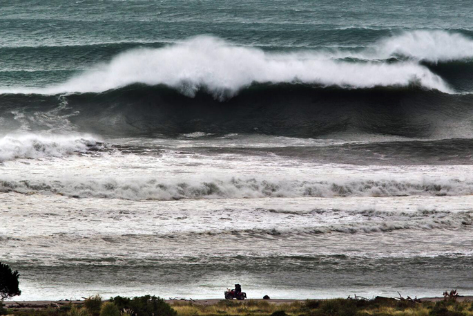
An oceanic phenomenon is likely to play a pivotal role when Tropical Cyclone Vaianu makes landfall on Sunday, coinciding with high tides and powerful winds hitting the North Island’s east coast.
With storm surges expected, the inverse barometer effect may shape how much the Category 2 storm wreaks havoc on communities in the firing line.
The inverse barometer (IB) effect is an oceanic phenomenon that causes sea levels over a given area to fall or rise when the atmospheric pressure increases or decreases.
“You can think of a low-pressure [system], whether it’s a tropical cyclone or not, as a hole in the atmosphere. It’s a big hole, and that creates a lot of wind,” Earth Sciences NZ chief scientist Chris Brandolino told the Herald.
“The deeper the hole, the stronger the low, or the lower the air pressure, what that does is that has an inverse effect where it elevates or raises the sea level.”
 The projected track of Cyclone Vaianu at 9am on Sunday, expected to make landfall between Auckland and Coromandel. Image / Windy.com
Brandolino compared it to the pitcher’s mound in American baseball, describing the effect as “a mini dome, [more] elevated than the rest of the field”.
“The low pressure basically helps draw the water up.”
Depending on the depth of atmospheric pressure, wind speeds and the tidal height at the time, Brandolino said, the phenomenon had the ability to intensify storm surges and potentially worsen flooding, coastal erosion and inundation from a cyclone hitting land.
“If [the IB effect] were to occur at high tide, or at the same time as big winds creating big waves which are moving onshore, those three things coming together increase the odds.”
It’s expected that Cyclone Vaianu will bring at least half a month’s worth of rainfall to various regions over the span of 24 hours.
“The rain hits the ground, that water runs off into streams and rivers, and those rivers get carried out to the ocean,” Brandolino said.
“If you have high tide, these big waves and this IB effect, where the sea level is essentially coming up [while] water is trying to escape, it gets backed up.
“It’s like having a backed-up drain; it has nowhere to go.”
Although the IB effect could add further risks to Vaianu’s impact, particularly on Sunday when tides are high and the storm is expected to be strongest, the intensity of storm surges is mainly driven by wind.
Waves are generated from wind transferring its kinetic energy into water, and given the high speeds predicted, Brandolino said, forecasters expected to see 10-12m waves generated offshore near the cyclone’s centre.
“That’s why it’s really critical to try to pinpoint where that centre goes, because where it goes, there’s a relationship to where the worst weather goes.”
And because low-pressure systems in the Southern Hemisphere move clockwise, “places like the Coromandel, places like Tairāwhiti Gisborne, even Hawke’s Bay and Bay of Plenty, are going to be getting winds coming off the ocean”, Brandolino said.
Along with the coastal impacts, Brandolino said there were concerns that some regions remained saturated. With soil unable to retain rainfall, it can increase Vaianu’s chance of creating surface run-off, causing flooding and erosion, which destabilises the soil holding bigger structures in place.
Combined with strong winds, this could mean downed power lines or trees, blocked roads and potentially bring widespread power outages to affected regions.
Cyclone Vaianu is expected to make landfall between Auckland and Coromandel when it reaches New Zealand on Sunday.
In advance, MetService has issued 18 heavy rain and strong wind watches across the North Island from Saturday evening, with the worst of the cyclone expected on Sunday afternoon.

0 comments
Leave a Comment
You must be logged in to make a comment.