


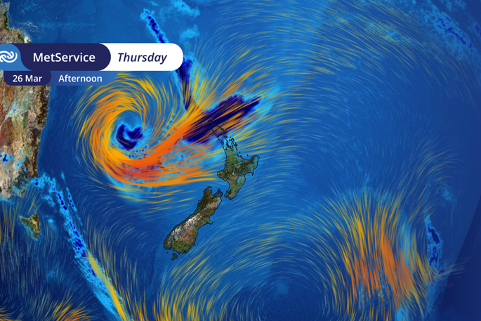
Tauranga residents are being urged to prepare for a stretch of heavy rain, strong winds and rough seas later this week.
A large tropical low moves south into the Tasman Sea from Wednesday, bringing widespread impacts across the country.
MetService said the system will first reach the northern North Island midweek, before spreading nationwide during Thursday and Friday.
The Bay of Plenty, including Tauranga, is expected to feel the effects as strengthening northeasterlies and persistent rain push down the coast.
While initial yellow heavy rain and strong wind watches have been issued for Northland, forecasters warn that further watches and warnings for other regions are expected in the coming days.
MetService meteorologist Alanna Burrows said the event will be “long‑lasting,” with several days of wet and windy weather expected as the system moves slowly across the country.
“With some settled weather and time on your side beforehand,” she said, “perhaps you could check in with your neighbours as well as prepare your property by securing items that can be picked up by strong winds.”
What Tauranga can expect
Heavy rain is forecast to develop across the region from late Wednesday or early Thursday.
Strengthening northeasterly winds may reach gale in exposed coastal areas, including Mount Maunganui and along the Tauranga coastline.
A large northerly swell will affect the northeast coast, with waves over 4 metres possible further north and significant sea conditions likely for Bay of Plenty surfers, fishers and boaties.
Unusual swell for the region
Burrows said the expected sea conditions are out of the ordinary, especially for the normally sheltered northeastern coastline.
“This event is very different, with moderate to heavy northerly swell impacting large areas of the coast, including some regions that are usually quite well protected,” she said.
Through Friday, the swell is forecast to intensify further down the country, with wave heights exceeding 6 metres along some South Island west coast locations.

0 comments
Leave a Comment
You must be logged in to make a comment.