
Weather records have been broken following January’s deluge of rain.
Tauranga recorded its wettest January since records began in 1910, with 408.9mm of rain observed at MetService’s weather station at Tauranga Airport.
MetService said Tauranga’s official wettest day (9am to 9am the next calendar day) was on January 21, with 274.0mm.
Tauranga experienced a wetter 24-hour period between May 17-18, 2005, but this rainfall was spread across two official reporting days, as daily rainfall is measured from 9am to 9am for climatological records.
Whitianga recorded 247.6mm on January 21, while 135.7mm fell in Timaru.
Looking ahead to this week, MetService is forecasting a couple of wet days in the Bay of Plenty before sunshine returns to the region on Wednesday.
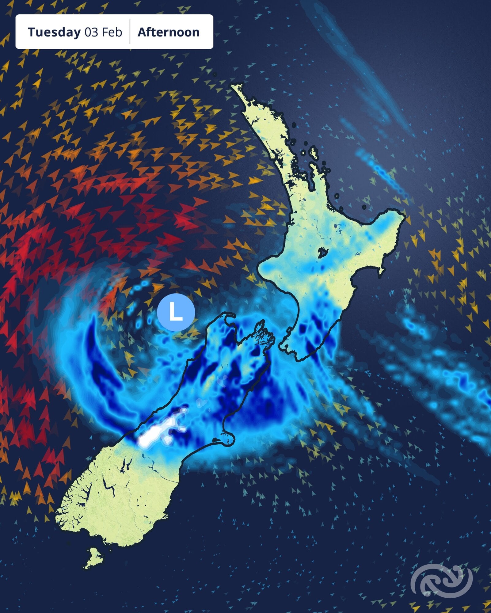
A low is expected to circle the South Island on Tuesday. Image / MetService
“There’s a soupy mess of humid air covering much of the North Island today, and a low-pressure system moving in from the Tasman Sea,” MetService meteorologist Michael Pawley said.
“Rain is trekking up the South Island today, getting heavier about central New Zealand today as the low crosses over. There is even the possibility of snow above 1200 metres about Canterbury from Tuesday afternoon.”
MetService has a heavy rain watch about the Westland ranges south of Fox Glacier until this evening.
Today there is a heavy rain watch for Marlborough south of Seddon, and Canterbury north of the Rangitata River, which has a high chance of being upgraded to an orange rain warning.
In addition, there is a strong wind watch for southeasterlies about Fiordland, Westland and Grey District.
MetService has heat alerts for Napier and Hastings today, which are expected to reach 32C and 33C respectively.
Much of the North Island has a muggy night ahead. Napier has an overnight minimum temperature of 23C, and Auckland will only drop to 21C.
On Tuesday, the maximum temperature for Canterbury will be in the early hours of the morning. Christchurch will drop to a chilly 12C for most of the day.

0 comments
Leave a Comment
You must be logged in to make a comment.