


Thunderstorms are on the cards for the Bay of Plenty today.
WeatherWatch.co.nz says conditions about northeastern parts of the North Island become a little unstable this afternoon, this will lead to isolated showers and some may become heavy with thunderstorms.
"This is for inland Hawke's Bay / East Cape and through inland Bay Of Plenty, the highest risk is for the ranges of East Cape," says a spokesperson for the weather organisation.
Thunder was heard rolling about Tauranga on Sunday, with many people taking to social media to report hearing it.
Some people noted there was no rain, while others said there was some rain up in the Kaimai Range area.
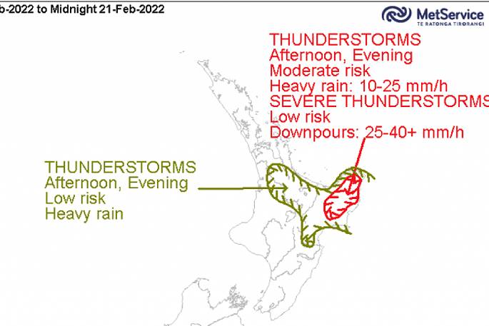 MetService thunderstorm risk for today – MetService.com.
COLD FRONT MOVING ONTO THE LOWER SOUTH ISLAND TOMORROW
A cold front is due to move onto the lower South Island tomorrow morning, with it come ssome rain, says WeatherWatch.co.nz.
"The further north the front moves, it slows down and weakens so Canterbury for example will likely only get showers for a time in the evening/overnight.
"Nelson and Marlborough stay dry all day, perhaps Marlborough might briefly see a shower on Wednesday first thing in the morning. Buller may actually see an isolated shower on Wednesday afternoon.
"Wellington up through to Gisborne gets a few showers on Wednesday as southwesterly winds spread northwards during the day."

0 comments
Leave a Comment
You must be logged in to make a comment.