


Severe gales and heavy rain is being for parts of central and southern New Zealand, and heavy snow possible in the far south.
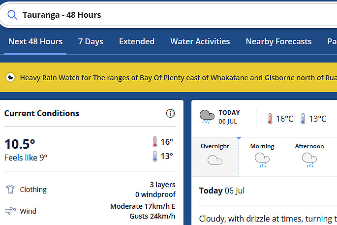
Early morning drizzle in the Bay of Plenty this morning is expected to turn to rain this afternoon.
The MetService has issued a severe weather watch for the region.
'A complex front moves northeast across the South Island today, then over the North Island during Wednesday,” says the weather organisation.
'This front is preceded by strong north to northwest winds, and followed by a cold southwest change.
'Warnings and watches for wind, rain, and snow are now in force for parts of central and southern New Zealand.
'People are advised to keep up to date with the latest forecasts in case any changes are made, or further areas are added.”
HEAVY RAIN WATCH
Area: The ranges of Bay Of Plenty east of Whakatane and Gisborne north of Ruatoria
Valid: 14 hours from 5am to 7pm Wednesday
Forecast: Periods of heavy rain. Rainfall amounts may approach warning criteria.
Area: Mount Taranaki
Valid: 7 hours from 8pm Tuesday to 3am Wednesday
Forecast: A period of heavy rain. Rainfall amounts may approach short-duration warning criteria.
Area: The Nelson ranges west of Motueka
Valid: 8 hours from 3pm to 11pm Tuesday
Forecast: A brief period of heavy rain, and possible thunderstorms.
Rainfall amounts may approach short-duration warning criteria.
HEAVY SNOW WATCH
Area: Northern parts of Southland, and southern parts of Otago
Valid: 7 hours from 1am to 8am Wednesday
Forecast: Snow is forecast to lower to 200 metres overnight Tuesday and may briefly become heavy. Snow amounts may approach warning criteria above 400 metres during this time.
Area: Fiordland south of Dusky Sound
Valid: 7 hours from 11pm Tuesday to 6am Wednesday
Forecast: Snow is forecast to lower to 200 metres overnight Tuesday, and may become heavy for a time. Snow amounts may approach warning criteria above 400 metres.
STRONG WIND WATCH
Area: Taranaki about and south of the mountain, northern parts of Whanganui, and Taihape
Valid: 11 hours from 6pm Tuesday to 5am Wednesday
Forecast: North to northwest winds may approach severe gale in exposed places at times.
Area: Marlborough
Valid: 12 hours from 12pm Tuesday to 12am Wednesday
Forecast: North to northwest winds may approach severe gale in exposed places at times.
Area: Inland parts of Otago
Valid: 6 hours from 9am to 3pm Tuesday
Forecast: North to northwest winds may approach severe gale in exposed places at times.
Area: Southland west and north of Mossburn, also Fiordland
Valid: 3 hours from 9am to 12pm Tuesday
Forecast: North to northwest winds may approach severe gale in exposed places at times.

0 comments
Leave a Comment
You must be logged in to make a comment.