


A severe weather warning remains in place across the Bay of Plenty for Sunday morning.
A weather front moved over the upper North Island last night and a complex low is forecast to move onto the North Island this morning, MetService advises.
That low will bring with it the risk of heavy easterly rain across the eastern regions of the North Island and upper South Island.
Across the Bay of Plenty, the warning is of an expected further 50 to 90mm of rain on top of the already heavy rainfall from Saturday.
Peak intensities of 20 to 30mm of rain per hour are possible this morning.
Heavy rain may cause streams and rivers to rise rapidly. Surface flooding and slips are also possible and driving conditions may be hazardous.
It comes amid continued bad weather across the North Island. A tornado in Papatoetoe, Auckland, yesterday tore down trees and damaged homes whilst one person died during the adverse weather condition in Wiri.
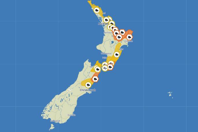
A severe weather warning is in place for the Bay of Plenty. Photo. MetService.
The severe weather warning extends into Gisborne, north of Tolaga Bay, with 70 to 100mm of rain expected.
There is also a low risk of thunderstorms from Gisborne, Bay of Plenty and northern Waikato northwards, warns MetService.
That risk becomes moderate for Northland, Great Barrier Island and the Coromandel Peninsula.
'Any thunderstorms that occur will likely bring heavy rain with intensities of 15 to 25 mm per hour, and strong wind gusts of 80 to 100 km/h,” says a MetService statement.
For Great Barrier Island and the Coromandel Peninsula there is also a low risk they may become severe, however for Northland the risk of severe thunderstorms during the early hours of Sunday is moderate.
Localised downpours in Northland of 25 to 40 mm per hour are possible as well as small tornadoes. Any tornadoes that occur will be localised.

0 comments
Leave a Comment
You must be logged in to make a comment.