



A heavy rain watch has been issued for the Bay of Plenty.
The MetService is forecasting heavy rain, mostly for the ranges east of Whakatane, from 9am Monday to 11am Tuesday.
While Tauranga may not be directly in line for the severe weather, rain is being forecast for the afternoon.
"A front moves east across the North Island today (Monday), bringing periods of heavy northerly rain to central parts of the North Island," says the MetService.
"A heavy rain warning remains in force for Mount Taranaki. A heavy rain watch remains in force for the remainder of Taranaki north of the mountain, Waitomo, Taumarunui, Tongariro National Park and the ranges of eastern Bay of Plenty.
"People are advised to keep up to date with the latest forecasts in case any watches are upgraded to warnings or further areas are added."
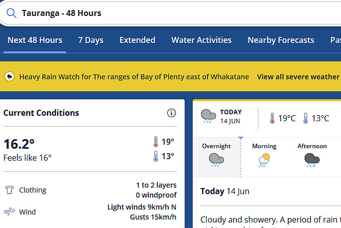 Image: MetService.
Heavy Rain Warning
Heavy rain may cause streams and rivers to rise rapidly. Surface flooding and slips are also possible and driving conditions may be hazardous.
Area: Mount Taranaki
Valid: 10 hours from 9am to 7pm Monday
Forecast: Expect a further 60 to 90mm of rain to accumulate on top of what has already fallen. Peak rates of 15 to 20mm/h.
Heavy Rain Watch
Area: The ranges of Bay of Plenty east of Whakatane
Valid: 26 hours from 9am Monday to 11am Tuesday
Forecast: Periods of heavy rain. Rainfall amounts may approach warning criteria.
Area: Taranaki north and east of the mountain, also Waitomo, Taumarunui and Tongariro National Park
Valid: 11 hours from 9am to 8pm Monday
Forecast: Periods of heavy rain. Rainfall amounts may approach warning criteria.

0 comments
Leave a Comment
You must be logged in to make a comment.