UPDATE 8.58AM: Moturiki/Leisure Island is open this morning.
The island was closed on Sunday due to heavy seas poising a danger to the public.
Tauranga City Council contractors have been out assessing the area this morning and a council spokesperson says it is open.
Meanwhile, the Mauao Base Track will re-open today once and tree has been cleared.
"We hope this will be by mid-morning," says council.
"Tracks to the summit are open. There are warning signs in place advising of the closures, but please be mindful that there may be some damage to the tracks due to the storm.
"We'll have our people on site this afternoon to assess where the base track will need to be closed for the next high tide."
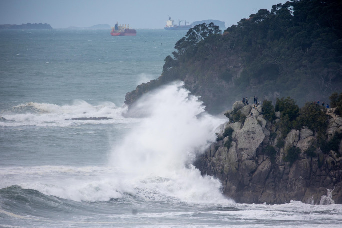
The closures were put in place around 3pm on Sunday due to dangerous sea swells which breached the Mauao base track and crossed over the sand bar at the back of Moturiki, says council.
EARLIER:
Contractors are out and about this morning assessing coastline following monster swells on Sunday.
Waves of up to 6.5m were recorded in Bowentown, while MetService recorded 8m swells in Pukehina.
There are no reports of road closures in the Coromandel this morning, but Tauranga City Council contractors are assessing the situation at Moturiki/Leisure Island.
The island, on Mount Main Beach, was closed on Sunday due to heavy seas posing a danger to the public.
Police were called to Moturiki to help enforce the closure as many of the public continued to cross over the sand bar to the rock outcrops and Moturiki itself.
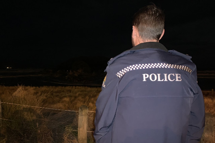 Police checking to see that no one was out at Moturiki this evening. Photo: Rosalie Liddle Crawford.
Tauranga City Council Natural Environment Adviser for Mauao Josh Clark says they were going to reassess the situation at 7am today.
An update is expected later this morning.
High tide was at 4.35am. Sunrise was at 7.15am.
Another high tide later today is at 5.14pm.
Meanwhile, a strong wind warning remains in place.
The MetService is forecasting southeast gales for parts of the North Island
A deep, slow-moving low northeast of New Zealand directs a strong, moist southeast flow across the North Island through to Tuesday, says the weather organisation.
"A strong wind warning remains in force for eastern Bay of Plenty and Gisborne north of Ruatoria, while Strong Wind Watches are in force for western parts of Taranaki, and the area near the ranges of eastern Bay Of Plenty, eastern Taupo, eastern Taihape and inland Hawkes Bay between Opotiki and the Napier-Taihape Road.
"Strong wind gusts could damage trees, powerlines and unsecured structures. Driving may be hazardous, especially for high-sided vehicles and motorcycles."
Area: The eastern Bay of Plenty east of Opotiki and Gisborne north of Ruatoria
Valid: 30 hours from 8pm Sunday to 2am Tuesday
Forecast: Severe gale southeasterlies in exposed places at times, with gusts reaching 120km/h, especially during Monday.

1 comment
Great photos and text.
Posted on 24-05-2021 16:33 | By morepork
Thanks.
Leave a Comment
You must be logged in to make a comment.