High pressure looks set to dominate New Zealand this week but it comes with a catch - it will have some localised low pressure caught up in it too.
It's a basic yet complicated forecast with high pressure mainly controlling our weather this week yet at the same time an area of sinking air pressure is entwined, meaning we have a mainly calm week ahead with daily downpours.
Very generally speaking the North Island looks more exposed than the South Island does this week for areas of patchy showers or downpours, shifting the recent dry spell back to a more normal set up for this time of the year (ie, a mix of dry and wet weather), says WeatherWatch.co.nz
"The further south you go the drier this week looks, which will be welcome news in water logged Southland.
"The high over New Zealand is a bit like a tyre with a leak in it, meaning it's not fully inflated over all of the country which allows for more cloud and some wet weather to sneak in or develop."
Some of the afternoon downpours which develop this week (and coming weekend) will be heavy, especially inland where daytime heating may contribute to bigger downpours and even isolated thunderstorms again.
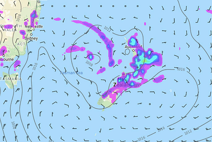 1pm rain and air pressure map for Wednesday shows high pressure in charge but locally low pressure sticking around the North Island / MetOcean.

0 comments
Leave a Comment
You must be logged in to make a comment.