Tropical Cyclone Fehi will lose it's tropical cyclone status today as the Category 1 storm shifts over cooler waters, as it tracks south towards New Zealand.
"However, the storm will retain damaging winds, big seas and flooding rains as it moves into the South Island's West Coast on Thursday," says WeatherWatch.co.nz
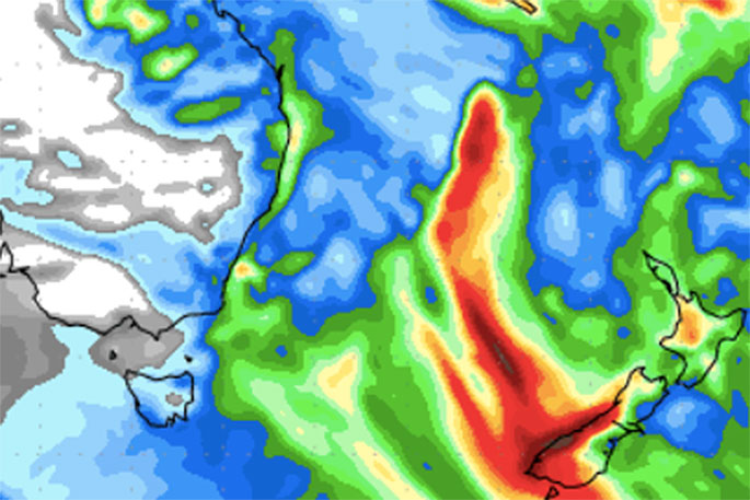
"There is some positive news - the worst of the rain will fall in Fiordland, a rain forest. The area is used to getting heavy rain - but do not underestimate the energy in this small but aggressive storm.
"The storm will make landfall most likely on the West Coast during the day on Thursday. The North Island misses the storm itself for the most part but does not escape the humid and heavy areas of rain the low will drag down."
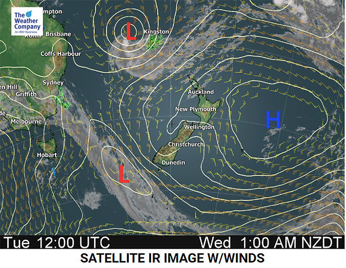
- Tropical Cyclone Fehi is now tracking quickly southwards at 32km/h, with the low averaging 65km/h winds around the centre.
- Kingston - the capital of Norfolk Island - has already been affected by Fehi's strong winds.
- Rain will start in the South Island around noon on Wednesday when Fehi and a southern cold front begin to merge.
- The centre is expected to make landfall near Milford Sound, South Island - but could be further north.
- Heavy rain then moves to the North Island from Thursday night to Friday morning.
- 250 to 300mm of rain is possible along the West Coast, especially in the southern half.
- Keep up to date with tax funded warnings from Government forecaster MetService.
- Hot in many places in the east on Thursday but a colder southerly change arrives later as the low tracks through.
- Daytime highs in Central Otago and surrounds could tumble by as much as 20 degrees on Thursday from where they were on Tuesday.
- The remnants of Fehi will track through fairly quickly over Thursday with the worst clearing the South Island by early Friday AM.

0 comments
Leave a Comment
You must be logged in to make a comment.