The calm, clear conditions seen in the weekend have been driven by high pressure sitting over New Zealand, which is slow to move off again.
A low pressure system in the Tasman is held at bay for the next few days, although cloud will increase and a few showers make their way onto western parts, says the MetService.
Winds will also switch around to the north, bringing in warmer air.
This combined with the increased cloud means warmer temperatures and fewer frosts, and also that the dry weather is coming to an end.
On Wednesday, the low pressure system makes inroads onto the country, spreading rain up the West Coast and into central New Zealand.
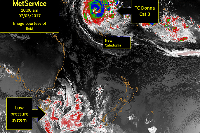
Meanwhile, Tropical Cyclone Donna, which is currently curving southeast between Vanuatu and New Caledonia, is likely to have weakened considerably but could still bring an influx of tropical air to the north of New Zealand.
'There is a lot of uncertainty in TC Donna's track,” says meteorologist Lucent Evens.
'But the presence of tropical air adding to the low pressure system brings a chance of amplification and some heavy falls.
'Expect some rain by the end of the week, and keep an eye on watches and warnings in case there is any severe weather mixed in.”

0 comments
Leave a Comment
You must be logged in to make a comment.