


Cyclone Pam has been downgraded to an intense tropical low as wind speeds near the centre of the system drop slightly and the storm continues its path around East Cape.
At 7am today, the storm centre was still north east of the Cape and appears to be taking a wider swing earlier predicted. It is expected to lie about 150km east of the Cape by noon today.
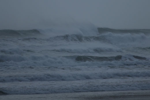
The waves off Papamoa Beach this morning, near Harrison's Cut. Photo: Christian Froehlich.
Meanwhile, emergency services in the Western Bay of Plenty have reported a quiet night.
Tauranga Fire Service senior station officer, Len Sabin, says: 'We had some extra crew up at Greerton to man the command unit just in case we got busy, but it appears we got off lightly,”
'We didn't get any incidents at all in town. The last incident was a car accident yesterday afternoon, which was completely unrelated.”
Metservice spokesman John Law says the 1.30am satellite picture of westerly winds at upper levels have pulled the high cloud away from the cyclone's centre, indicating the transition to an extra tropical cyclone.
A wind gust of up to 150 kilometres per hour was observed near Kaeo in Northland and a gust of 144 was recorded at Channel Island between the Coromandel Peninsula and Great Barrier Island on Sunday evening.
The wave recorder on the Port of Tauranga's A Beacon is this morning recording a peak wave height of 5.5 metres on top of a 4m swell. Tauranga airport rain gauge recorded 7mm of rain yesterday.
Metservice spokesman John Law expects the main impact of the storm to be felt east of Edgecumbe.
'It's still close by,” says John. 'It's still got strong winds to come as it get closer to East Cape, and we are still going to find more wet and windy weather.
'For the Bay of Plenty, it's more likely to be east of Edgecumbe. The strongest winds will be in the Eastern part of the Bay of Plenty as the winds come over and down the hill.
'As the system continues to move down toward the south the wind is going to be more south or south easterly.”
The strongest winds and heaviest rain is still expected to be in the North-East corner from Gisborne to East Cape.
'The heaviest rainfall is still the other side of the hills,” adds John. 'Gisborne District Council got 200mm rain.”
Storm warnings and watches are still in force for the Western Bay of Plenty.

0 comments
Leave a Comment
You must be logged in to make a comment.