Map images of town roads, new subdivisions and town layout changes will soon feature aerial images that are being photographed from the sky this week.
The Thames Coromandel District Council says it is using a fixed wing aircraft first, with a camera mounted in the bottom, while smaller areas will be photographed using a drone.
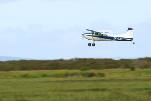
The aerial photography team taking off from Thames earlier this week. Photo: TCDC
The updated aerial photography will replace the last photographs taken in 2010, which are now out of date in many parts of the Coromandel.
Once finished and edited, the new images will be freely available to download and will help ratepayers with development plans.
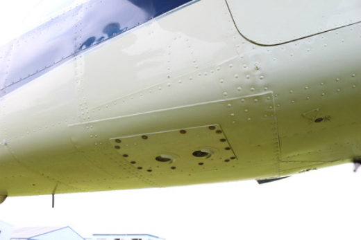
Holes built into the underside of the aircraft allow the camera to take photographs while small metal protrusions provide a slipstream that shields the camera lens from the wind.
The urban areas being photographed are:
- Hikutaia
- Puriri
- Totara/Kopu
- Thames/Tararu
- Whakatete
- Thornton Bay/Ngarimu Bay
- Te Puru
- Waiomu
- Ruamahanga
- TapuTe Mata
- Manaia
- Te Kouma
- South Coromandel
- Coromandel
- Oamaru Bay
- Kikowhakarere Bay
- Papa Aroha
- Amodeo Bay
- Waitete Bay
- Coville
- Otautu Bay
- Port Charles
- Little Bay
- Tuateawa
- North Kennedy Bay
- Kennedy Bay
- Whangapoua
- Matarangi
- Rings Beach
- South Kuaotunu
- Otama
- Opito
- Matapaua Bay
- Wharekaho
- Whitianga
- Cooks Beach / Ferry Landing
- Hahei / Cathedral Cove
- Hot Water Beach
- Tairua
- Pauanui
- South Pauanui
- Opoutere
- Onemana
- Whangamata
- Kuaotunu/Kuaotunu East
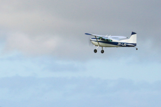
The aerial photography team in n flight above Thames on Tuesday morning.

0 comments
Leave a Comment
You must be logged in to make a comment.