


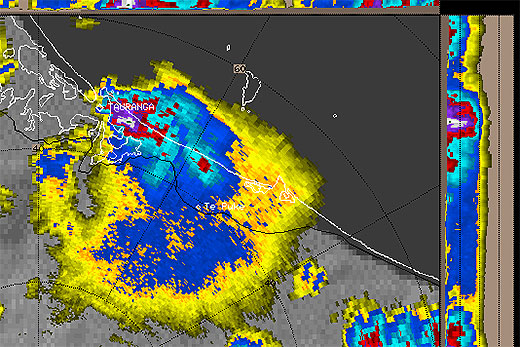
It's shaping up to be another week of fast-changing weather as strong winds run across New Zealand from the north then switch to the south before finally easing off at the end of the week.
The change from the northerlies to southwesterlies put the likes of Auckland, Coromandel and the Bay of Plenty in the firing line for some stronger winds yesterday, but they are expected to ease today.
Wind and more rain is being forecast for the Bay this week.
MetService meteorologist Georgina Griffiths says the weather will get much better before the kids go back to school.
For Central parts of the country, it was a very unsettled start on Monday, with gale force northwesterly winds along the Kapiti Coast and around the capital.
Although they eased in the morning, severe weather warnings and watches remained in place for part of the North Island as winds swung around to the South.
The warnings for the Bay of Plenty and Coromandel have since been lifted.
The MetService is warning that southerly changes are set to bring some cooler temperatures across parts of the country.
The Desert Road was due to see some snow overnight and early this morning but the MetService predicts this to clear up later in the day.
'Another blast of northwest gales is possible for the likes of the Canterbury High Country and central New Zealand around the middle of the week,” says meteorologist John Law.
'With those winds we are also expecting some heavier rain onto the West Coast again. The good news is that the weather looks a little more settled towards the weekend.”
Despite temperatures by day still reaching the high teens for many parts of the country, the lighter winds and some clearer skies later in the week could spell some frosty nights, especially for the more sheltered, inland parts of the country.


0 comments
Leave a Comment
You must be logged in to make a comment.