


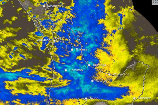
Ex-tropical Cyclone June is set to bring rain and strong winds to the region this week as it moves down the North Island.
The former cyclone from New Calendonia is expected to hit the top of the North Island late Monday afternoon before moving over the central North Island into the Bay of Plenty early Tuesday.
Rain radar for the Bay of Plenty. Photo: MetService.
Metservice meteorologist Elke Louw says widespread rain is expected to cover the North Island.
'Strong or gale force winds are likely as the low crosses the North Island, particularly over the sea, and heavy swells may affect the east coast from Cape Reinga to Bay of Plenty on Tuesday.”
The MetService is issuing a severe weather watch for the Bay of Plenty with heavy rain expected in the eastern areas on Tuesday.
'This watch is for the possibility of southwest gales becoming severe about exposed parts of Coromandel Peninsula and Western Bay of Plenty in the lee of the Kaimai Range on Tuesday.”
The weather forecaster says there is also a risk of thunderstorms with the rainband in Coromandel Peninsula and near the coast over the far east of the Bay of Plenty tonight.
A gale warning has been issued for coastal areas of the Bay of Plenty with northeast winds changing to southwest 40knots on Tuesday. Winds are expected to gust up to 55knots late Tuesday afternoon before easing to 30knots at night.
Cyclone June was reclassified as an ex-tropical cyclone by the Fiji Meteorological Service on Sunday.

0 comments
Leave a Comment
You must be logged in to make a comment.