


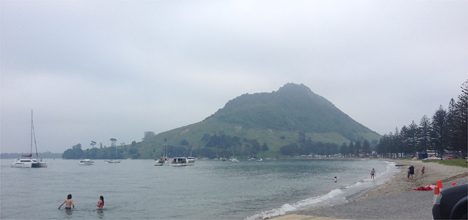
It was an eerie sight over Tauranga skies at the weekend as a weather phenomenon blanketed the city in a haze.
SunLive received numerous calls about the hazy and cloudy conditions experienced across the region on Saturday.
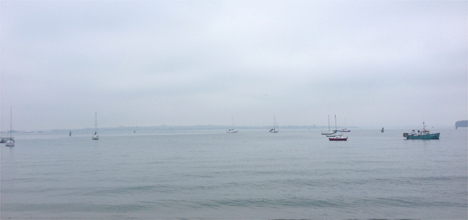
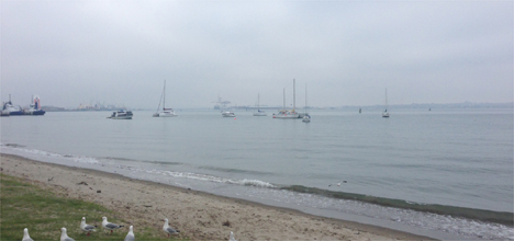
A haze caused by salt particulates sat over Tauranga City at the weekend. Photos: Tracy Hardy.
It has now been confirmed as a sea haze caused by a temperature inversion.
Metservice meteorologist Dan Corbett says a sea haze is when salt particles in the air, that would normally be blown away, linger.
'The inversion is the thing that determines how far daily particulates, from a city's smoke stacks, or from the sea, go up in the atmosphere,” says Dan.
The inversion layer was created by the high pressure area sitting over the far north for a good part of last week. It fluctuated at about 2000ft (600m), while the wind remained a steady north to north-west.
'The weather stayed pretty similar over days and the inversion didn't break, so it just kept everything there, collecting over the days,” says Dan.
'Until you get a front to break that inversion, or bring some rain, the air stays pretty similar.”
The inversion is a layer of warm air. Air typically gets cooler as it rises.
'Warm air would rise like a cloud, it wold keep going up until it got to the point where it was pretty chilled out and reaching its equilibrium point.
'When you see the clouds of the day they all get up to about their condensation level and they will also get to a point where they are similar to the surrounding temperatures and that's why they condense to form a cloud.
'But when the inversion is there, that layer of air that is warmer than the air below it. When the heating of the day tries to warm it and push it higher, it can't.
'It's a bit like a like on a slow cooker, it keeps all the particulate salt haze that flows off the sea.”
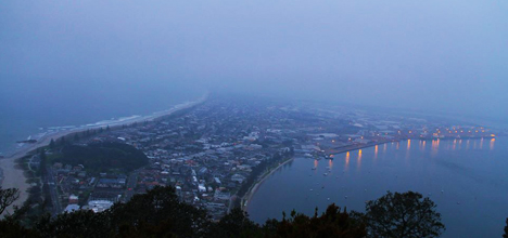
View from the Mount. Photo by Daniel Hines.

0 comments
Leave a Comment
You must be logged in to make a comment.