


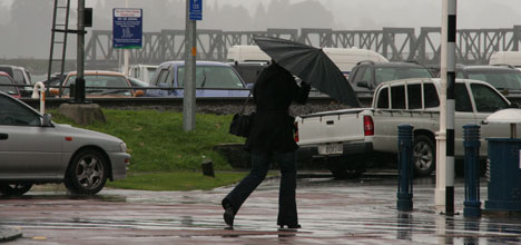
Background conditions, which contributed to Tauranga's massive winter storm during June 19-21, are going to continue for the next three months, say Niwa climatologists.
Niwa's recently released winter outlook for the Bay of Plenty is rainfall for the July-September period is likely to be normal or above normal in the east of the North Island.
Rainfall will be normal or below normal in the west and south of the South Island, and in the near-normal range for other regions.
A 'weak easterly flow anomaly” is likely to remain over the country because the equatorial Pacific Ocean remains in a neutral state – neither El Niño nor La Niña. And, the neutral conditions are expected to persist for at least the coming three months.
For New Zealand it means higher pressures than normal are forecast south of the country, with slightly lower pressures than normal in the north Tasman Sea. This circulation pattern is likely to produce the weak easterly flow.
It is a continuation of the conditions in June – of persistent high pressure centres south and southeast of Tasmania, and lower pressures than normal across New Zealand and to the north and northeast of the country. It resulted in an anomalous east-southeasterly flow over the South Island, contributing to well above normal rainfall recorded throughout areas to the east of the Southern Alps.
It also provided the conditions setting up the storm of 19-21 June, which brought the strongest sustained 10-minute winds that Wellington airport has seen since 1985. These strong winds resulted in widespread damage to infrastructure and vegetation in Wellington, and a loss of power for up to 30,000 homes. In addition, cold south-southeasterly winds associated with the storm resulted in significant snowfall across the South Island. Areas of the Mackenzie Country and the Maniototo bore the brunt of snowfalls, with unofficial reports of more than half a metre of snow there. Most South Island ski areas received in excess of one metre of new snow by the end of the storm, with Mt Hutt inundated by an estimated new snowfall total approaching three metres.
While June was a relatively wet month for eastern and northern parts of the South Island, as well as southern and southeastern parts of the North Island, rainfall was below normal in parts of Fiordland, West Coast, Manawatu, inland Taranaki and eastern Bay of Plenty. Rainfall was above normal in the Bay of Plenty.
July-September temperatures are very likely to be above average in North Island regions; and likely to be average or above average in all South Island regions. Nevertheless, cold snaps, frost and snow conditions will still occur in many areas from time to time, as is typical at this time of year.
Soil moisture levels are likely to be normal or above normal in the east of the South Island, and near normal in other regions. River flows are likely to be normal or above normal in the southwest of the North Island, normal or below normal in the west and south of the South Island, and near normal in other regions.
The sunniest four centres so far in 2013 (January to June) are: Whakatane 1435 hours, New Plymouth 1390 hours, Blenheim 1273 hours and Paraparaumu 1261 ho

0 comments
Leave a Comment
You must be logged in to make a comment.