


Bay of Plenty Regional Council is reopening parts of Pāpāmoa Hills Cultural Heritage Regional Park tomorrow.
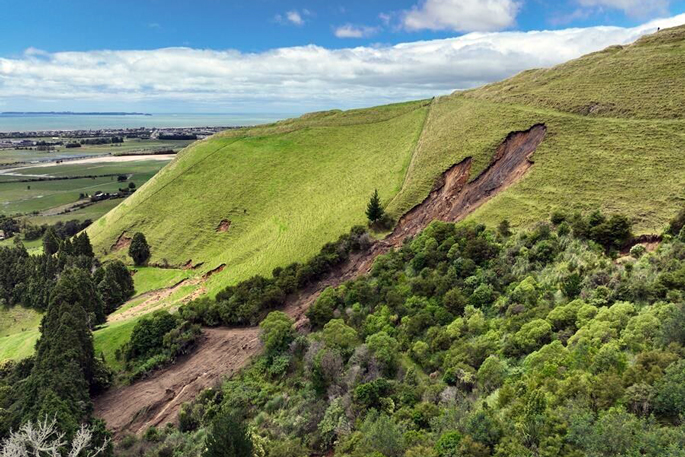
The park has been closed since January 22, when heavy rainfall triggered more than a dozen significant landslides across the site, damaging walking tracks and park infrastructure.
Bay of Plenty Regional Council councillor and Te Uepu co-chair Kat Macmillan said staff and contractors have worked hard to restore public access where it is safe to do so.
“Our priority has been making sure the park is safe for the community. Since January, regional council staff, members of Te Uepu, specialist contractors and geotechnical engineers have been working together to assess the damage and carry out essential repair works.”
Te Uepu co-chair Spencer Webster echoed this sentiment.
“Our cautious agreement to this first stage of re-opening reflects the assurances we have received regarding public safety and the safeguarding of these important heritage sites.
“As we move through the staged reopening, iwi will continue to work closely with the regional council to ensure that every step taken upholds the safety of the community and the integrity of this treasured taonga.”

This map indicates which parts of the park remain closed, because of landslide risk, and which parts are now open. Photo / Bay of Plenty Regional Council
Tracks reopening from Friday, April 3:
- Pūraho Track (to/from far Poplar Lane carpark to the trig/summit)
-Karangaumu Track via alternative track (to/from main Poplar Lane carpark)
-Summerhills Track (to/from Summerhill Recreation Farm carpark on Reid Rd to trig/summit).
Tracks remaining closed because of ongoing damage and instability:
-Pāpāmoa Track
-Te Ihu o Ruarangi Track
-Te Hōuāwe Track
-Te Kaingapākura Track.
Signs have been installed throughout the park to clearly mark which areas remain closed.
Visitors were asked to keep to the open tracks and stay off closed trails because of the continued landslide risk.
Two carparks were available at Pāpāmoa Hills Cultural Heritage Regional Park, providing access to open trails and a route to the summit. Motorists were reminded not to park along Poplar Lane roadside.
Parks and reserves open around Tauranga
After the heavy weather on March 26 and 27, many of Tauranga parks and walkways have now reopened, Tauranga City Council said.
This included Hopukiore/Mt Drury, McLaren Falls Park and Te Rere o Ōmanawa/Ōmanawa Falls, Waikareao Estuary Walkway (Daisy Hardwick Walkway), Puketoromiro Pā in Kōpūrererua Valley, the Novella Place slip repairs area and the walkway on the estuary side off Seventh Ave.
Ōropi Grove mountain bike park remained closed, the council said.
“Geotechnical work is ongoing to assess four slips that have affected the tracks. Fencing and signage are in place – please respect this closure for your own safety. "

Flooding at the Greerton Marist Rugby grounds. Photo / Rosalie Liddle Crawford
Flooding at the Greerton Marist rugby grounds has now cleared but the playing surfaces were still waterlogged.
The council asked people to keep off the grounds while they fully dry out, to avoid further damage.
“We will notify the clubs when training and play can commence again.”

1 comment
Well…
Posted on 02-04-2026 17:23 | By Shadow1
…. Tauranga City Council haven’t finished talking about the Mount tracks yet, and it will take a couple of months to read the reports if they get them this year. In the meantime, cruise ship tourists will all go to Rotorua or not come at all.
This is one of the most important repair projects in years and they’re sitting on their hands.
Shadow1.
Leave a Comment
You must be logged in to make a comment.