After a soggy start to the week for many, the end of the week brings sunnier skies and a return to chilly winter nights.
While people in southern and eastern parts will still see a few showers, for the rest of the country the weekend is a great time for outdoor plans, whether you’re heading out for a stroll, off to a Saturday sports game, working in the garden, or taking the opportunity to hang the washing out, said the MetService in its latest weather update.
Today’s action is in the upper North Island: eastern parts of Auckland and Northland, as well as Taranaki, may hear a rumble of thunder or receive a scattering of hail this afternoon as some beefier showers roll through.
“With heavier showers expected right around school-run time and into rush hour, make sure to keep an eye on the rain radar to see if any pop up near you,” said MetService meteorologist Silvia Martino.
Luckily for those cleaning up after heavy rain and flooding in Bay of Plenty yesterday, just a few showers are forecast for the region today, although the odd shower might still be heavy.
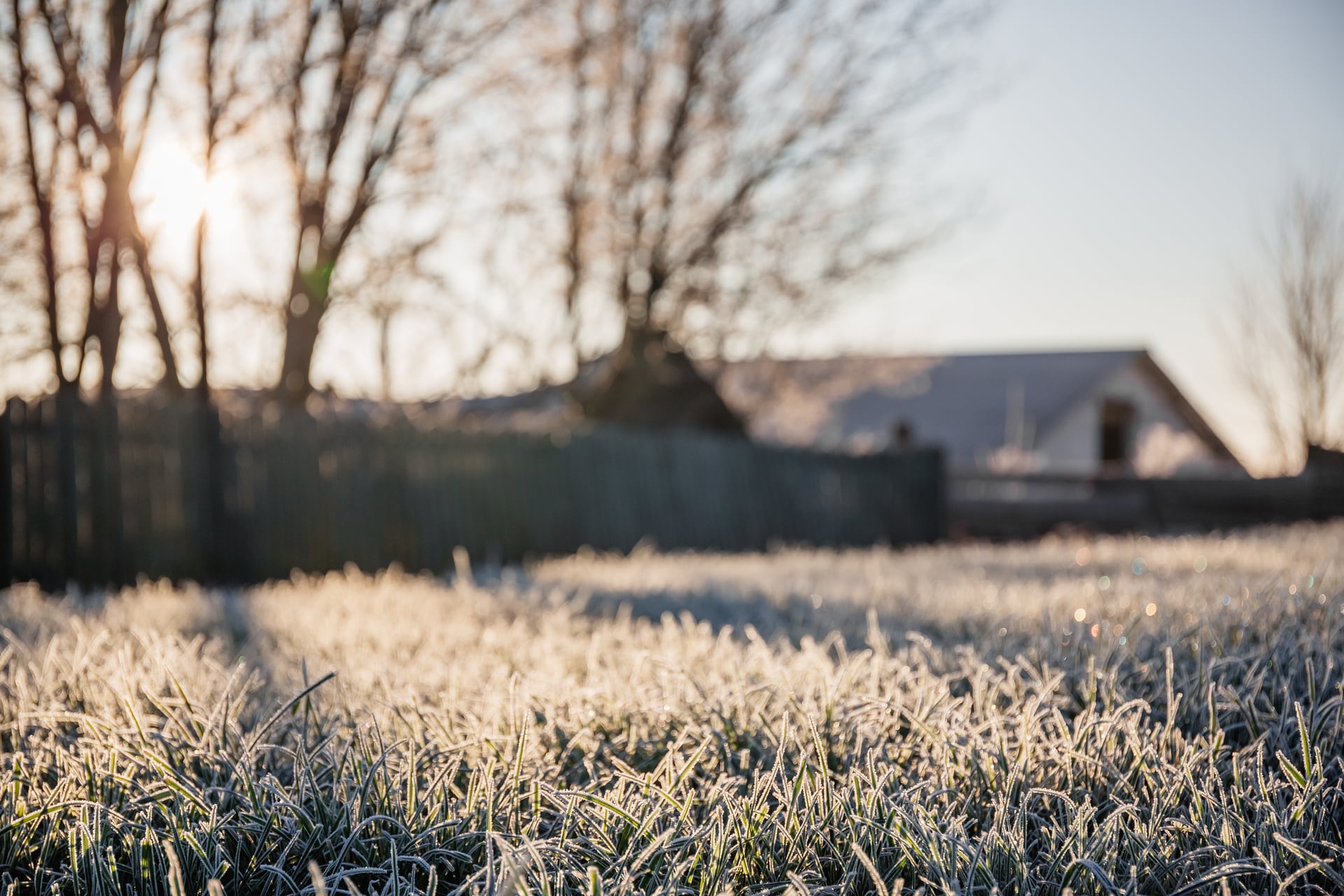
There’s one more month of meteorological winter, and the next few days will certainly feel like it.
Overnight temperatures dip into the negatives for much of the country, and many areas in the South Island will be back to single-digit daytime highs.
“Clear skies, cold air, and light winds are perfect conditions for frosty nights and mornings – watch out for icy roads and bring any precious pot plants in out of the cold,” Martino suggested.
There is light on the horizon, though, with longer days bringing more daylight hours.
Today the country receives an average of 45 minutes more daylight than we did a month ago on the shortest day of the year, and during August we’ll add another hour and a quarter to that.
All eyes (and ears) have been on the tsunami advisories issued by Nema for coastal regions of Aotearoa New Zealand.
MetService supports the distribution of this safety-critical messaging with a banner on its marine forecast pages directing users to https://www.civildefence.govt.nz/ for the most up-to-date information, as well as advising people through individual coastal and recreational marine forecasts to expect strong and unusual currents and unpredictable surges at shore.
“The wave models used by weather forecasting agencies capture waves produced by wind and weather, so the swell heights in our marine forecasts don’t include any contribution from tsunami waves.
“Tsunami modelling is carried out by specialists at Earth Sciences New Zealand [formerly GNS Science], and messages issued by Nema represent the official warning status for New Zealand.”


0 comments
Leave a Comment
You must be logged in to make a comment.