Heavy rain, strong winds and large northeast swells are all on the cards for the Bay of Plenty tomorrow.
MetService has issued severe weather warnings and watches for heavy rain and strong wind, as a frontal system is set to move slowly over the country on Tuesday.
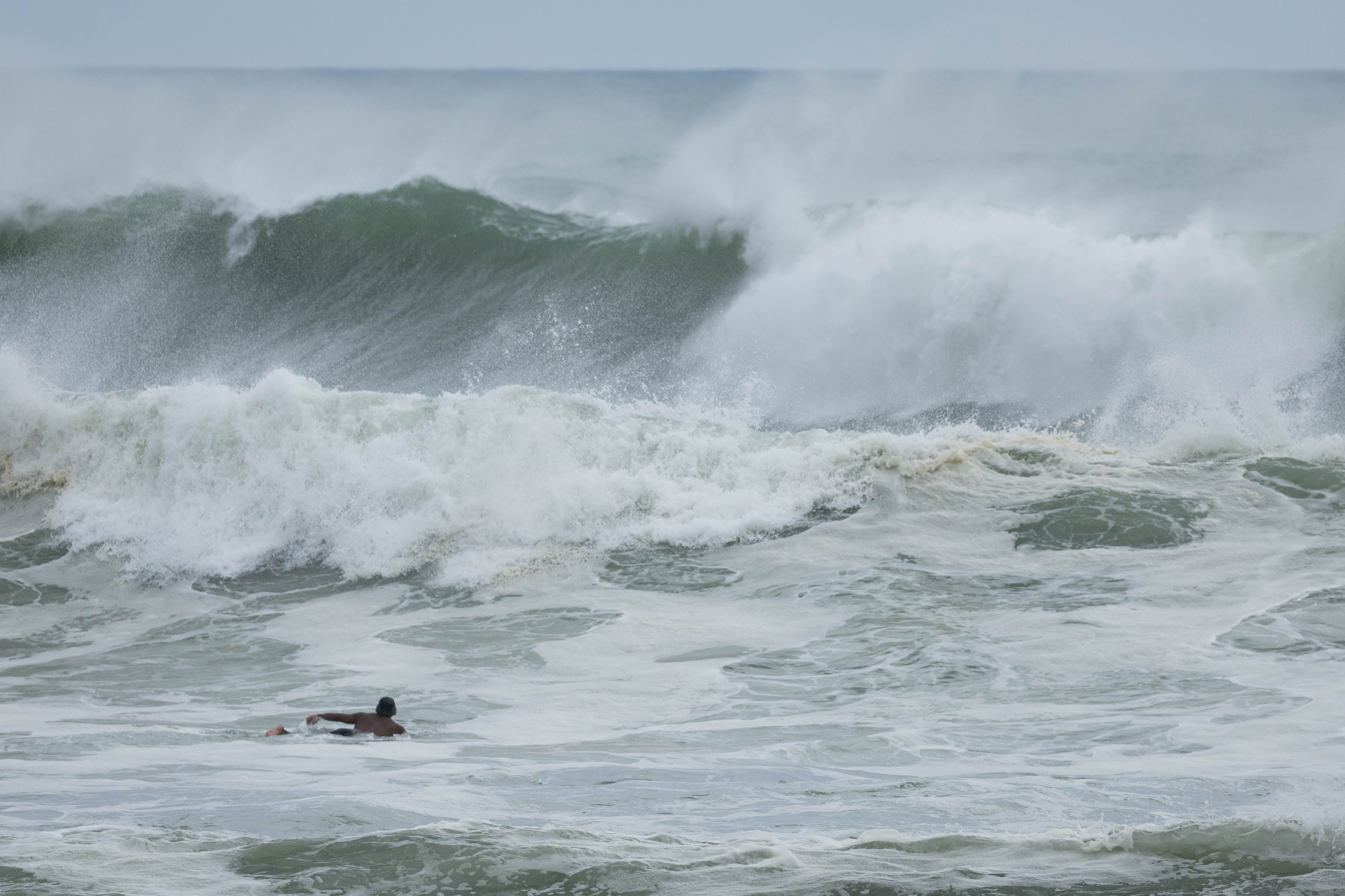
Large northeast swells are also expected for the east coast of the upper North Island, including parts of Whakatāne.
The front is forecast to arrive early tomorrow and depart to the east on Wednesday afternoon and will pack a punch while it crosses the country, MetService said.
Blustery northeasterly winds, widespread heavy rain – even downpours – are likely.
In the North Island, orange heavy rain warnings have been issued for the Coromandel Peninsula, Bay of Plenty, Taranaki Maunga and central North Island mountains.
For the South Island, orange heavy rain warnings are in force for Tasman, Nelson, western Marlborough, the ranges of Westland, the headwaters of the Otago lakes and rivers, and the Canterbury lakes and rivers south of Arthurs Pass.
Heavy rain and strong wind watches have been issued for much of the central and upper North Island.
MetService meteorologist Alwyn Bakker advised extra caution for “Tasman east and south of Motueka, excluding Nelson City District, where there is a high chance the orange warning will be upgraded to a red warning. Aside from Motueka township, this is the same region that was covered by a red warning back on July 11”.
There’s also a moderate risk for inland parts of the Bay of Plenty to be upgraded to a red warning.
Swells of 3 to 4.5 metres were forecast on Tuesday for parts of the east coast between the Bay of Islands and Whakatāne.
“Northeast swell is expected to peak at 4 metres in the Bay of Islands on Tuesday morning, and at 4-4.5 metres at Great Mercury Island in the evening.
“Northerly swell is expected to peak at 4-4.5 metres at Whakatāne around midnight.”
Along with the wind and rain, overnight temperatures are expected to rise.
Much of the North Island will stay above 10°C on Tuesday night. Whakatāne will be particularly notable, with its overnight minimum of 13°C only 2C cooler than its recorded maximum temperature on Sunday.
Towards the end of the working week, a deep low to the east of New Zealand was forecast to direct a strong southerly flow on to the eastern North Island, while a second low is expected to move east past the Far North.
“At this stage, the risk of severe weather from Thursday onwards is minimal, but MetService advises that people keep an eye on the forecast.”

0 comments
Leave a Comment
You must be logged in to make a comment.