.jpg)
GNS Science has issued a new Volcanic Alert Bulletin late this morning for Whakaari/White Island volcano, with the alert level back up to 3 with aviation setting back to orange
"Another minor eruption occurred at Whakaari/White Island at approximately 8.10am, NZST today, May 25," says Duty Volcanologist Yannik Behr.
"The Volcanic Alert Level has been raised to Level 3 and the Aviation Colour Code changed to Orange."
Yannik says further minor volcanic eruptive activity occurred on Saturday morning at Whakaari/White Island.
"Footage from our Whakatane camera indicates that this morning’s activity is very similar in size to what was observed yesterday.
"We noticed a vigorous steam-gas plume above the island at 8.10 am NZST."
.jpg) Image taken at 8am, Saturday, May 25. Image: GNS.
Image taken at 8am, Saturday, May 25. Image: GNS.
.jpg) Image taken at 8.10am, Saturday, May 25. Image: GNS.
Image taken at 8.10am, Saturday, May 25. Image: GNS.
As GNS Science has no sensors on the island, they are relying on webcams and satellite imagery to assess the situation.
The on-island monitoring equipment continued working for a while after the eruption in 2019, but in the harsh environment the network needs regular servicing. Without attention, it has deteriorated over time and the last functioning seismo-acoustic station stopped working completely in August 2022.
"Based on our limited information there were no clear indications of volcanic ash in the plume. If there were, it would be unlikely to reach the mainland under current wind conditions," says Yannik.
He says the steam-gas plume above the island has now reverted to more normal levels.
"GNS Science volcanologists are monitoring the volcano and further information will be released as available. As that information becomes available, we may change the Volcanic Alert Level to more accurately reflect the current situation."
The Bay of Plenty Civil Defence Emergency Management team is liaising with GNS Science and the duty team.
"At this stage I consider the main risk to the public is potential anxiety and the unwelcome reminder of December 2019, so we are keeping that front of mind," says BOP CDEM Duty Public Information Manager Lisa Glass.
"Nothing has changed in terms of advice to the public or any potential safety concerns. Ash fall is not expected to reach land, and the Regional Council harbourmaster advises that boaties and other maritime vessels should avoid the waters around the island."
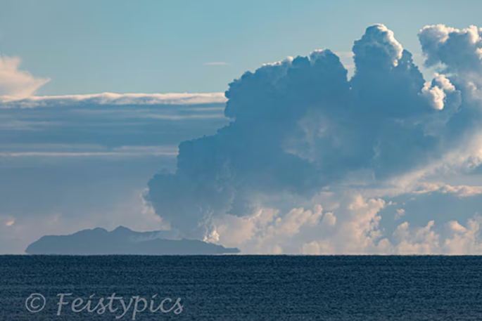 A large steam plume seen rising from Whakaari/White Island on Friday in what GNS Science described as a minor eruption. Photo / Wayne Feisst.
On-island monitoring vs remote monitoring
On-island monitoring gives GNS the ability to detect and confirm eruptions, substantially improving the chance of forecasting changes in activity, and provide real-time monitoring in bad weather and at night. Basically, the closer the equipment is to the volcano, the sooner they get data or can confirm that the volcano might be doing something significant.
Without on-island monitoring, their ability to detect and confirm eruptions at Whakaari is limited. At present, the Volcanic Ash Advisory Centre at MetService provides most of the ability to confirm eruptions, via satellite remote sensing and rain radar data.
The GNS combined remote monitoring toolkit includes monitoring stations on the mainland, observation and gas flights, and remote sensing technology, like radar, gas, and thermal satellite imagery. They also receive information about Whakaari from satellite data from the German and European Space Agencies, which can provide them a view of ground deformation and gas emissions.
Remote monitoring data is valuable, albeit lesser quality information than on-island instruments can provide.

0 comments
Leave a Comment
You must be logged in to make a comment.