
A heavy rain warning is now in place for the Bay of Plenty.
The MetService is forecasting extended periods of "significant heavy rain" for northern and western parts of New Zealand.
"Severe north to northeast gales for northern and central New Zealand are also being predicted," says a spokesperson for the weather organisation.
"A slow-moving complex trough of low pressure, preceded by a moist northerly flow,covers New Zealand today.
"The trough is expected to move slowly eastwards across the county late Thursday and Friday.
"This weather system is forecast to bring an extended period of northerly rain to northern and western parts of New Zealand, where numerous heavy rain warnings and watches are in place.
"Red Heavy Rain Warnings are in force for Buller and Westland."
In addition, gale to severe gale north to northeasterly winds will affect northern and central parts of New Zealand, and strong wind warnings and watches are in place, says the MetService.
"This is expected to be a significant weather event, especially for places where soils are already saturated from recent rain.
"People are advised to keep up to date with the latest forecasts, as some other areas could be upgraded to a Red Warning, and more areas may be added."
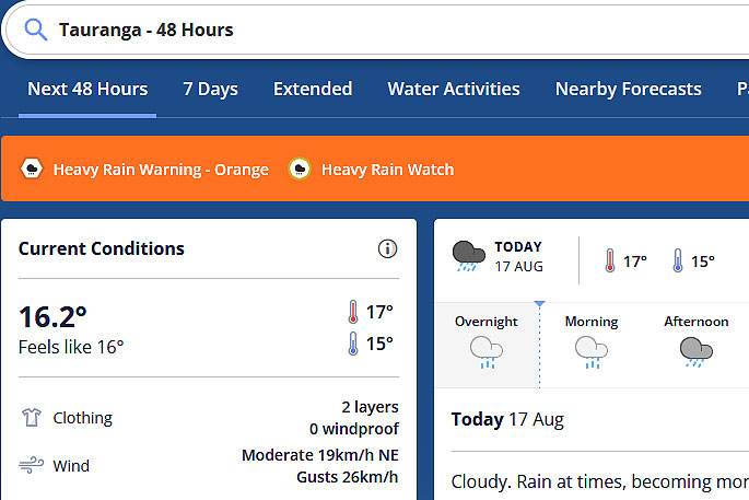 Image: MetService.
========================
HEAVY RAIN WARNING - RED
========================
This rain is expected to cause dangerous river conditions and significant flooding. Slips and floodwaters are likely to disrupt travel, making some roads impassable and possibly isolating communities.
Area: Buller
Valid: 34 hours from 9am Wednesday to 7pm Thursday
Forecast: Periods of heavy rain. Expect a further 200 to 300 mm of rain to accumulate about the ranges south of Little Wanganui on top of what has already fallen, and 100 to 200 mm elsewhere. Peak rates of 15 to 20 mm/h about the ranges today.
Area: Westland
Valid: 32 hours from 9am Wednesday to 5pm Thursday
Forecast: Periods of heavy rain. Expect a further 200 to 300 mm of rain to accumulate about the ranges on top of what has already fallen, especially between Bruce Bay and Otira, and 80 to 150 mm about the coast. Peak rates of 10 to 20 mm/h about the ranges. Thunderstorms possible in the south on Thursday.
Note, heavy rain could ease for a time from late Wednesday morning to late Wednesday afternoon.
===========================
HEAVY RAIN WARNING - ORANGE
===========================
Heavy rain may cause streams and rivers to rise rapidly. Surface flooding and slips are also possible and driving conditions may be hazardous.
Area: Northland
Valid: 35 hours from 7pm Wednesday to 6am Friday
Forecast: Expect 150 to 220 mm of rain to accumulate, especially in the north and east. Peak rates of 15 to 25 mm/h on Thursday.
Area: Auckland and Great Barrier Island
Valid: 28 hours from 10pm Wednesday to 2am Friday
Forecast: Expect 110 to 140 mm of rain. Peak rates of 10 to 20 mm/h.
Change note: Upgraded to an Orange warning
Area: Bay of Plenty west of Edgecumbe
Valid: 26 hours from 1am Thursday to 3am Friday
Forecast: Expect 120 to 170 mm of rain. Peak rates of 10 to 15 mm/h.
Area: Waikato south of Raglan, Waitomo, Taumarunui
Valid: 29 hours from 1am Thursday to 6am Friday
Forecast: Expect 120 to 180 mm of rain, especially in western areas.
Peak rates of 10 to 15 mm/h expected.
Change note: Upgrade to an Orange warning
Area: North Taranaki away from the Mountain
Valid: 32 hours from 1am Thursday to 9am Friday
Forecast: Expect 120 to 180 mm of rain. Peak rates of 10 to 15 mm/h expected.
Change note: Upgrade to an Orange warning
Area: Tongariro National Park
Valid: 31 hours from 1am Thursday to 8am Friday
Forecast: Expect 180 to 240 mm of rain. Peak rates of 10 to 15 mm/h.
Area: Mount Taranaki
Valid: 57 hours from 9am Wednesday to 6pm Friday
Forecast: Expect 400 to 500 mm of rain to accumulate. Peak rates of
15 to 25 mm/h.
Change note: Brought start time forward to 9am
Area: The Tasman District west of Motueka
Valid: 36 hours from 9am Wednesday to 9pm Thursday
Forecast: Periods of heavy rain. Expect a further 300 to 500 mm of rain to accumulate about the ranges on top of what has already fallen, and 120 to 220 mm about low lying areas. Peak rates of 15 to 25 mm/h about the ranges.
Area: The Tararua Range
Valid: 27 hours from 12pm Thursday to 3pm Friday
Forecast: Expect 120 to 180 mm of rain. Peak rates of 10 to 15 mm/h.
Area: The Marlborough Sounds, Richmond and Bryant ranges, Rai Valley and Nelson District
Valid: 38 hours from 9am Wednesday to 11pm Thursday
Forecast: Periods of heavy rain. Expect a further 250 to 400 mm of rain to accumulate about the ranges on top of what has already fallen, and 100 to 200 mm elsewhere. Peak rates of 10 to 20 mm/h about the ranges.
============================
STRONG WIND WARNING - ORANGE
============================
Strong wind gusts could damage trees, powerlines and unsecured structures.Driving may be hazardous, especially for high-sided vehicles and motorcycles.
Area: Northland
Valid: 32 hours from 3pm Wednesday to 11pm Thursday
Forecast: Northeast gales are forecast to be severe at times, with gusts reaching 120 km/h in exposed places.

0 comments
Leave a Comment
You must be logged in to make a comment.