
A high pressure system that has given us settled weather over the weekend is now weakening.
WeatherWatch says on its way out to the east, a front approaches from the Tasman Sea.
North Island, it's a frosty start for some inland areas, fog possible this morning too then breaking away, expect high cloud for most regions.
"Expect areas of mid level cloud for the upper North Island, a few light showers about eastern Northland spread into Coromandel later then Bay Of Plenty overnight.
"There may also be some mid level cloud in the southwest (Taranaki through to Wellington), especially this morning. Light winds in the east, northeasterlies out west."
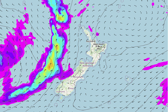 Image: WeatherWatch.co.nz.
It's also a frosty start in the south, more so inland. People can expect sun and thickening high cloud today.
"Mid level cloud thickens for the West Coast with a few light showers moving in this morning, turning to rain this evening then becoming heavy.
"Rain spreads into Nelson overnight from the west. Northesterly winds, freshening up a little this afternoon, winds ease in the east overnight."

0 comments
Leave a Comment
You must be logged in to make a comment.