


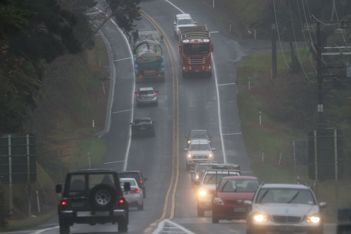
Heavy rain and severe gales are being forecast for many parts of New Zealand.
Heavy snow is also on the cards for parts of Canterbury and Otago, says the MetService.
"A deep low and associated fronts are forecast to move slowly south-southeast across New Zealand from tonight and during Tuesday, then away to the east of the South Island on Wednesday," says a spokesperson for the weather organisation.
"This weather system is expected to bring heavy rain and severe gales to many parts of the country. In addition, rain is expected to fall as snow down to 400 metres in Canterbury and 500 metres in Otago on Tuesday, with warning amounts of snow expected about and above 500 metres over inland Canterbury south of Waimakariri River, and possibly above 600 metres in the remainder of inland Canterbury and inland Otago."
Warnings and watches for heavy rain and severe gales are in force for many places.
Also, heavy snow warning is now in force for Canterbury High Country south of Waimakariri River including the Mackenzie Basin, while watches for the likelihood of warning amounts of snow remain in force for the remainder of Canterbury High Country and inland Otago.
"This is a significant event. People are advised to keep up to date with the latest forecasts as parts of these watches will likely be upgraded to orange warnings, or more areas added."
See below for more information on regional warnings and watches.
===========================
HEAVY RAIN WARNING - ORANGE
===========================
Heavy rain may cause streams and rivers to rise rapidly. Surface flooding and slips are also possible and driving conditions may be hazardous.
Area: Coromandel Peninsula
Valid: 17 hours from 6pm Monday to 11am Tuesday
Forecast: Expect 90 to 110 mm to accumulate, especially about the ranges. Peak rates of 15 to 25 mm/h on Tuesday.
Area: Bay of Plenty including Rotorua
Valid: 17 hours from 10pm Monday to 3pm Tuesday
Forecast: Periods of heavy rain. Expect 90 to 120 mm, but localised
120 to 150 mm to accumulate. Peak rates of 15 to 25 mm/h on Tuesday.
Area: Gisborne north of Tolaga Bay
Valid: 21 hours from 8pm Monday to 5pm Tuesday
Forecast: Expect 110 to 150 mm to accumulate. Peak rates of 20 to 30 mm/h during Tuesday.
Area: Taupo, Taihape
Valid: 13 hours from 10pm Monday to 11am Tuesday
Forecast: Expect 70 to 100 mm to accumulate, especially about the mountains and ranges. Peak rates of 15 to 25 mm/h.
Change note: Area has been split and watch for Taupo and Taihape upgraded to orange warning. Waikato remains under a heavy rain watch.
Area: Mount Taranaki
Valid: 11 hours from 12am to 11am Tuesday
Forecast: Expect 80 to 120 mm to accumulate. Peak rates of 15 to 25 mm/h.
Area: Tasman about and west of Motueka
Valid: 19 hours from 2am to 9pm Tuesday
Forecast: Expect 80 to 110 mm to accumulate. Peak rates of 10 to 20 mm/h.
Change note: Watch upgraded to orange warning.
Area: Tararua Range
Valid: 12 hours from 3am to 3pm Tuesday
Forecast: Expect 70 to 100 mm to accumulate. Peak rates of 15 to 25 mm/h.
Note, Wairarapa excluding Tararua Range and the Tararua District remains under a heavy rain watch.
Area: Marlborough including Kaikoura Coast
Valid: 12 hours from 3am to 3pm Tuesday
Forecast: Expect 100 to 140 mm of rain to accumulate about the Kaikoura Coast and ranges, and 70 to 100 mm elsewhere. Peak rates of 15 to 25 mm/h.
Area: Canterbury excluding Christchurch and Banks Peninsula
Valid: 19 hours from 7am Tuesday to 2am Wednesday
Forecast: Expect 70 to 90 mm to accumulate below 500 metres, with heavy snow expected above. See a separate heavy snow warning.
===========================
HEAVY SNOW WARNING - ORANGE
===========================
Heavy snow may disrupt travel in affected areas and could damage trees and powerlines. Cold conditions may cause stress for livestock.
Area: Canterbury High Country south of Waimakariri River including Mackenzie Basin
Valid: 16 hours from 8am Tuesday to 12am Wednesday
Forecast: Rain is forecast to fall as snow down to 400 metres, with heavy snow above 500 metres. Expect 20 to 40 cm of snow to accumulate above 500 metres with larger amounts expected above 800 metres.
Change note: Watch upgraded to orange warning. Canterbury High Country about and north of Waimakariri River remains under a heavy snow watch.
============================
STRONG WIND WARNING - ORANGE
============================
Strong wind gusts could damage trees, powerlines and unsecured structures.Driving may be hazardous, especially for high-sided vehicles and motorcycles.
Area: Auckland, Great Barrier Island
Valid: 7 hours from 2am to 9am Tuesday
Forecast: Northeast winds are forecast to rise to gale gusting 110 km/h.
Change note: Watch upgraded to wind warning.
Area: Tasman west of Motueka
Valid: 11 hours from 4am to 3pm Tuesday
Forecast: East to southeast winds are forecast to rise to severe gale gusting 130 km/h in exposed places.
Strongest winds are expected during the morning.
Change note: Watch upgraded to a orange warning. Tasman about and east of Motueka remains under a strong wind watch.
Area: Buller
Valid: 11 hours from 4am to 3pm Tuesday
Forecast: East to southeast winds are forecast to rise to severe gale gusting 140 km/h in exposed places.
Strongest winds are expected during the morning.
Change note: Watch upgraded to a orange warning.
Area: Westland about and north of Fox Glacier
Valid: 13 hours from 6am to 7pm Tuesday
Forecast: East to southeast winds are forecast to rise to severe gale gusting 120 km/h in exposed places.
Change note: Watch upgraded to orange warning. Westland south of Fox Glacier remains under a strong wind watch.
HEAVY RAIN WATCH
Area: Northland
Valid: 18 hours from 2pm Monday to 8am Tuesday
Forecast: Periods of heavy rain. Rainfall accumulations may approach warning criteria.
Area: Auckland, Great Barrier Island
Valid: 15 hours from 6pm Monday to 9am Tuesday
Forecast: Periods of heavy rain. Rainfall accumulations may approach warning criteria.
Area: Waikato excluding Coromandel Peninsula
Valid: 13 hours from 12am to 1pm Tuesday
Forecast: Periods of heavy rain. Rainfall accumulations may approach warning criteria.
Area has been split and watch for Taupo and Taihape upgraded to orange warning.
Area: Gisborne about and south of Tolaga Bay
Valid: 21 hours from 8pm Monday to 5pm Tuesday
Forecast: Periods of heavy rain. Rainfall accumulations may approach warning criteria.
Area: Hawke's Bay
Valid: 15 hours from 1am to 4pm Tuesday
Forecast: A period of heavy rain. Rainfall accumulations may approach warning criteria.
Area: The Tararua District and Wairarapa excluding Tararua Range
Valid: 12 hours from 3am to 3pm Tuesday
Forecast: A period of heavy rain. Rainfall accumulations may approach warning criteria.
Note, a heavy rain warning is now in force for Tararua Range.
Area: Christchurch including Banks Peninsula
Valid: 19 hours from 7am Tuesday to 2am Wednesday
Forecast: Periods of heavy rain. Rainfall accumulations may approach warning criteria.
Note, remainder of Canterbury is under heavy rain and heavy snow warning.
Area: North Otago, Dunedin
Valid: 20 hours from 12pm Tuesday to 8am Wednesday
Forecast: Periods of heavy rain. Rainfall accumulations may approach warning criteria.
Note, rain is expected to fall as snow above 500 metres.
HEAVY SNOW WATCH
Area: Canterbury High Country about and north of Waimakariri River
Valid: 16 hours from 8am Tuesday to 12am Wednesday
Forecast: Rain is forecast to fall as snow down to 400 metres, with warning amounts of snow possible above 600 metres.
Area: North Otago, Central Otago and the Queenstown Lakes
Valid: 13 hours from 12pm Tuesday to 1am Wednesday
Forecast: Rain is expected to fall as snow down to 500 metres, with warning amounts of snow possible above 600 metres.
STRONG WIND WATCH
Area: Northland
Valid: 10 hours from 9pm Monday to 7am Tuesday
Forecast: Northeast winds may approach severe gale in exposed places.
Area: Coromandel Peninsula, Waikato, Waitomo, Taumarunui and Taranaki
Valid: 9 hours from 2am to 11am Tuesday
Forecast: Northeast winds may approach severe gale in exposed places.
Area: Bay of Plenty, Rotorua, Taupo and Taihape
Valid: 11 hours from 3am to 2pm Tuesday
Forecast: Northeast winds may approach severe gale in exposed places.
Area: Whanganui, Manawatu, Kapiti-Horowhenua, Wellington, Marlborough Sounds
Valid: 29 hours from 2am Tuesday to 7am Wednesday
Forecast: East to southeast winds may approach severe gale in exposed places until 2 pm Tuesday.
Note, this watch has now been extended to cover the likelihood of severe gale northwesterlies from Tuesday evening to Wednesday morning.
Between 10pm Tuesday and 7am Wednesday, northwest winds may rise to severe gale in exposed places.
Area: Hawke's Bay south of Hasting, Wairarapa including the Tararua District
Valid: 27 hours from 5am Tuesday to 8am Wednesday
Forecast: Northeast winds may approach severe gale in exposed places at times until 2pm Tuesday.
Note, this watch period has now been extended to cover the likelihood of severe gale northwesterlies from Tuesday evening to Wednesday morning. Between 10 pm Tuesday and 8am Wednesday, northwest winds may rise to severe gale in exposed places.
Area: Tasman about and east of Motueka
Valid: 11 hours from 4am to 3pm Tuesday
Forecast: East to southeast winds may approach severe gale in exposed places.
Area: Westland south of Fox Glacier
Valid: 13 hours from 8am to 9pm Tuesday
Forecast: East to southeast winds may approach severe gale in exposed places at times.
Area: Christchurch including Banks Peninsula
Valid: 12 hours from 8pm Tuesday to 8am Wednesday
Forecast: Southwest winds may approach severe gale in exposed places.

0 comments
Leave a Comment
You must be logged in to make a comment.