


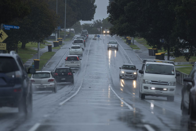
Thunderstorms are expected to affect western parts of the North Island from Waikato southwards until Thursday evening, bringing localised very heavy rain, hail and squally wind gusts.
Showers are expected in the Bay of Plenty in the morning and afternoon, then becoming fine.
The main threat to drivers further south is expected to be mostly slippery roads, ponding and surface water from heavier downpours and isolated thunderstorms, and some snow in the mountains of the South Island.
MetService has issued a severe thunderstorm watch for people living in Waitomo,Taranaki, Wanganui, Manawatu, Kapiti-Horowhenua, Wairarapa and Wellington.
Until 2pm Thursday, there is a risk that a few of these thunderstorms could be severe south of Raglan bringing rain with damaging wind gusts in excess of 110 km per hour, and one or two small or damaging tornadoes.
Wind gusts of this strength can cause some structural damage, including to trees and power lines, and may make driving hazardous.
If any tornadoes occur, they will only affect very localised areas.
Heavy rain, severe gales, and possible heavy snow are forecast for parts of central and southern New Zealand.
An unsettled north to northwest flow strengthens ahead of a cold front forecast to move across the country from the west on Friday.
This front brings about a change to strong and colder westerlies.
"Warnings and Watches for heavy rain and severe gales are in force for parts of central and southern New Zealand, and a Watch for heavy snow is now in force for Central Otago, the Queenstown Lakes district and southern parts of the Canterbury High Country," says a MetService spokesperson. "Note that the unsettled weather is expected to continue at least until Monday, and further watches and warnings for heavy rain, severe gales and heavy snow are likely to be issued for many areas in the coming days."
WeatherWatch also advise that a strong moist northwesterly and westerly flow will be bringing significant amounts of rain to many areas from Friday to Monday.
Conditions are likely to cool gradually over the South Island with snow expected in many mountain areas.
"Surface water, snow and strong winds look to be the main driving risks in the days ahead as a Southern Ocean storm brings a variety of severe weather to New Zealand," says a WeatherWatch spokesperson.
"All South Island Alpine Passes are expected to get snow in the coming days and some chance the Desert Road of the North Island will get a dusting by Tuesday, although the North Island isn't as impacted by colder air as the South Island is."
Snow could possibly lower to below 1000 metres at times. This is likely to be the first significant snow of the season and snow may lower to levels where it along with strong winds and cold temperatures can cause stress to livestock.
For Westland, the Canterbury high country and Buller there is a moderate confidence that rainfall accumulations will reach warning amounts at times from Friday to Sunday. Some of this precipitation is likely to fall as snow about the Alps.
For Fiordland and for areas extending slightly farther north and east from this moderate risk area there is a low confidence that rainfall accumulations will reach warning amounts at times from Friday to Sunday.
For Taranaki, especially about the Mountain and the west of the North Island high country there is a low confidence that rainfall accumulations will reach warning amounts from Friday to Sunday but the confidence of heavy rain is considered moderate for Monday.
For the Marlborough Sounds, Wellington and Wairarapa including the Tararua District there is a moderate confidence that northwesterlies will rise to severe gale at times from Friday to Monday.
For the Tararua Range there is a moderate confidence that rainfall accumulations
will reach warning amounts at times from Friday to Monday.
There is a low confidence of snow accumulations reaching warning amounts above about 800 metres for the Canterbury high country south of the Rangitata River and for Otago west of about Alexandra on Sunday. Note that this snow along with strong winds and low temperatures may cause stress to livestock.

0 comments
Leave a Comment
You must be logged in to make a comment.