Is New Zealand's east coast about to get what Australia's east coast just had?
This is a question being asked by WeatherWatch forecaster Phillip Duncan.
"It's a similar set up next week and although NZ's rainfall totals look lower than what Australia just had, totals may still exceed 200mm around Gisborne to Hawke's Bay with a chance of slips, flooding and road closures next week should this low move in," says Phillip.
The last 30 days have been relatively dry around Gisborne and Hawke's Bay. MetService are also forecasting that the eastern parts of the North Island are in for a stretch of persistent rain early next week due to a low pressure system forecast to approach East Cape.
"The severity of the rain and wind hangs on the position and depth of the system," says a MetSerivce spokesperson.
"The low, which a week ago was the twin low next to Cyclone Eva, will stall in the NZ area on Monday and linger for potentially over a week," says Phillip.
"Unfortunately many regions that need rain may miss out on wet weather from this set up."
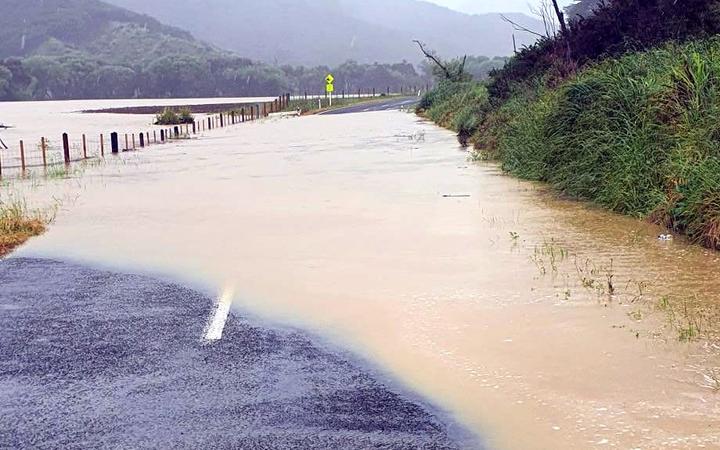
Tairāwhiti Civil Defence emergency manager Ben Green has alerted East Cape residents that they may be cut off by the deluge, with flooding possibly closing roads in the area.
Ben says the east coast could see anywhere from 200 to 400mm of rain in just a few days.
East Cape Road, which connects the area to Te Araroa, was closed for three weeks after heavy rainfall last month and it triggered several significant slips.
MetService says the low is forecast to become slow moving to the northeast of East Cape late Monday, then slowly move eastward from Wednesday.
"This low is expected to direct a moist south to southeast flow over central and northern parts of New Zealand and bring periods of heavy rain to eastern districts of the North Island," says a MetService spokesperson.
"The strength of the associated winds and amount of rainfall are dependent on the position and intensity of the low. At this stage, there is still some uncertainty regarding the exact track and intensity of this low."
MetService advises that there is a potential for this system to bring significant rainfall to Gisborne and Hawkes Bay, and severe gales to parts of the lower North Island and Marlborough Sounds.
"From Monday to Wednesday, there is moderate confidence of rainfall amounts reaching warning criteria in Gisborne and the Wairoa District, then the confidence reduces to low on Thursday.
"On Tuesday and Wednesday, there is low confidence of warning amounts of rain for eastern parts of Taihape and the remainder of Hawkes Bay," says a MetService spokesperson.
"For Wairarapa, there is low confidence of warning amounts of rain on Wednesday.
"In addition, on Tuesday and Wednesday, there is low confidence of severe gale south to southeasterly winds in exposed parts of the lower North Island from Taranaki across to eastern Bay of Plenty southwards and also for the Marlborough Sounds."
Large south to southeast waves and coastal inundation are possible in Hawkes Bay and Gisborne later on Tuesday and on Wednesday.
Expert meteorologists at the MetService continue to monitor the situation closely and people in the areas expected to be affected by this weather system are advised to keep up to date with the latest forecasts.

0 comments
Leave a Comment
You must be logged in to make a comment.