
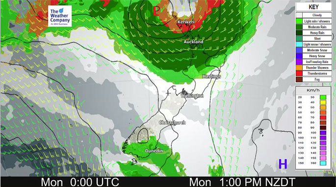
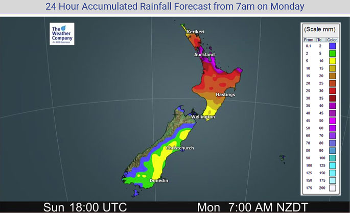
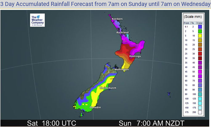
A tropical low starts to affect the North Island today moving in from the north, bringing heavy rain and increasing wind speeds.
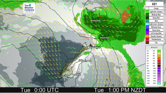
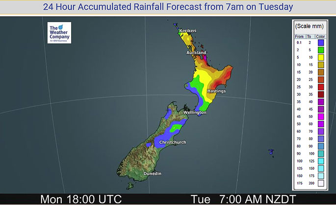
The South Island is more settled but a southerly airflow increases with showers developing about the far south then spreading northwards in the east.
"Rain affects most North Island regions today, heavy for some regions especially in the north," says WeatherWatch.co.nz.
"More details in the forecast below. The South Island sees showers in the south and eventually in the east."
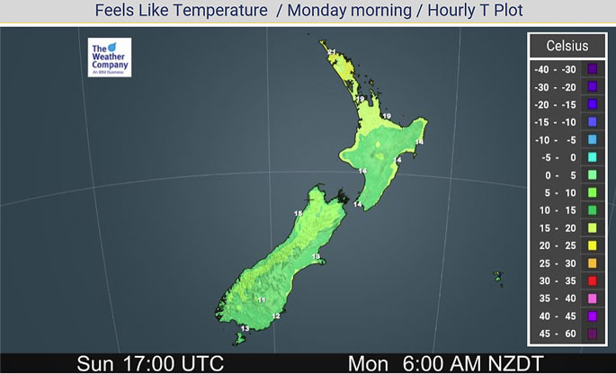
For today's temperatures and wind speeds check out the maps below.
North Island
Rain about Northland and Auckland spreads southwards to reach Wellington overnight.
"Rain will be heavy about Northland / Auckland this morning and Waikato / Bay Of Plenty across to East Cape this afternoon.
"Rain may also be heavy in a few other lower North Island areas as rain moves southwards but not as intense as further north."
Rain eases about Northland from afternoon, Auckland by evening.
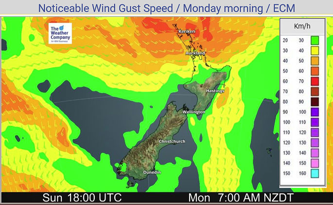
Gusty easterlies Waikato northwards, lighter winds further south but generally tending to the south or southeast as the day progresses.
Southerlies becoming strong to gale through Cook Strait overnight and about coastal Taranaki.
South Island
Mostly sunny for the West Coast and about Nelson / Marlborough, expect high cloud though, says WeatherWatch.co.nz
"Mostly sunny along the east coast also with high cloud, lower level cloud thickens about the far south this morning though bringing light showers.
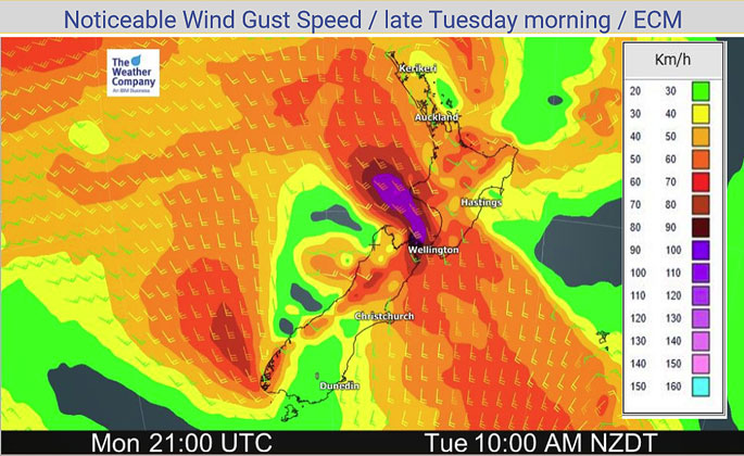
"Cloud and showers moves up into Canterbury during the course of this afternoon / evening, starting inland then spreading to the coast. Southerly winds freshen up later in the day.
"Mostly sunny for the West Coast and about Nelson / Marlborough, expect high cloud though. Mostly sunny along the east coast also with high cloud, lower level cloud thickens about the far south this morning though bringing light showers.
"Cloud and showers moves up into Canterbury during the course of this afternoon / evening, starting inland then spreading to the coast. Southerly winds freshen up later in the day."
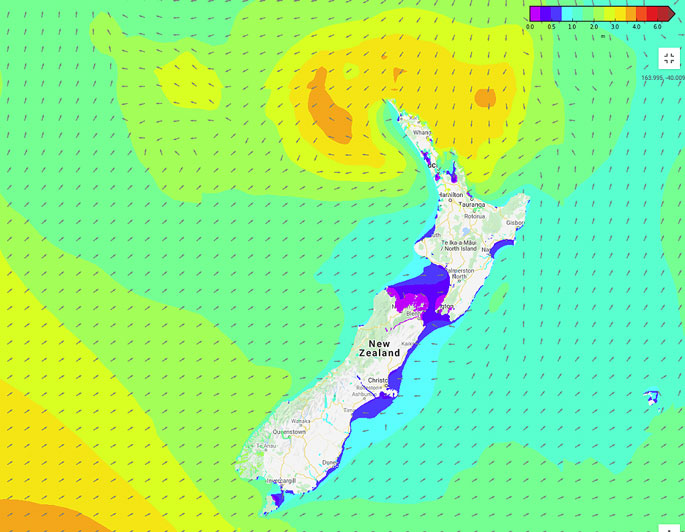 Swell map Monday 1pm.
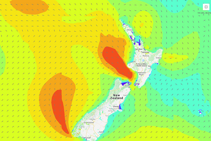 Swell map Tuesday 1pm.

0 comments
Leave a Comment
You must be logged in to make a comment.