New Zealand weather forecasters have been very busy over the first week of summer.
'The weather pattern over Aotearoa has been more spring-like than summery, as weather systems continued to bombard our shores, bringing gale to severe gale northwesterlies, torrential rain and severe thunderstorms,” says MetService meteorologist Andy Best.
'A ridge of high pressure north of the North Island remained in place since the start of last week. This so-called ‘blocking ridge' slowed systems down as they moved onto the country, allowing large accumulations of rain and preventing many of the fronts from moving up the North Island.”
On Tuesday and Wednesday, the fronts which moved over New Zealand resulted in Strong Wind Warnings and Watches being issued, extending from inland Canterbury northwards across much of the lower North Island, and gusts well over 100km per hour were recorded in the Capital on Tuesday.
Over the South Island, these fronts delivered heavy rain, accompanied by thunderstorms about and west of The Divide with a number of weather stations in the Alps recording 250 to 400mm in a 24hr period.
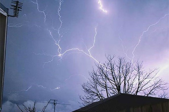
Severe Thunderstorm Warnings were issued on Saturday focusing on developments near Hokitika, as well as for an area just north of Warkworth. In the 24 hours leading up to 7am Sunday morning, 109,000 lightning strikes were recorded over New Zealand and surrounding waters, with 18,000 specifically over the land.
'Previously our records had only seen 44,000 strikes over both land and sea,” says Andy. 'Thunderstorms can bring localized flooding and downpours which have caused disruptions to travel. Please check with the NZTA website to ensure roads are open.
'The good news is that later today and during Monday we see a change to the weather pattern as a cold front moving up the country sees the rain over the South Island easing to showers, with the showers slowly becoming few and far between.
'As the cold front moves northeast across the North Island, the frontal rain eases to a mix of fine weather and isolated showers during Monday morning, although there is a chance of afternoon showers and thunderstorms popping up over inland areas.
'Tuesday looks like a mainly fine day, as a ridge moves over central and northern parts of the country, just isolated showers developing over Fiordland, Southland and Otago,” says Andy.


0 comments
Leave a Comment
You must be logged in to make a comment.