A series of fronts are forecast to move across New Zealand from the west through to overnight Wednesday, bringing periods of heavy rain and northwest gales to parts of southern and central New Zealand.
The Bay of Plenty is expected to miss this heavy rain and remain relatively fine with the odd shower and westerlies.
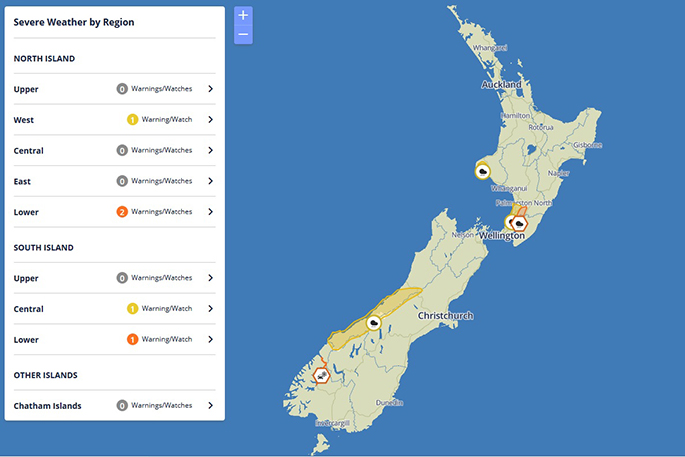
The largest accumulations of rain are expected about the Tararua Range, where a heavy rain warning remains in force.
Heavy rain watches will be maintained for Horowhenua, Kapiti Coast and Mount Taranaki, and the ranges of Westland, but the heavy rain watch for Wellington has now been lifted.
People in these areas are advised to keep up to date with the latest forecasts and warnings.
There is high confidence of rainfall accumulations reaching warning criteria in Fiordland and Westland on Tuesday, and moderate confidence for the headwaters of the Otago and Canterbury Lakes and Rivers (within 15km east of the main divide).
There is low confidence of warning amounts of rain for the ranges of Buller late Tuesday and early Wednesday, and also low confidence for the Tararua Range on Wednesday.
In addition, there is low confidence of northwesterly gales becoming severe in exposed parts of the Canterbury High Country on Tuesday, and in exposed parts of Marlborough, Wellington and Wairarapa late Tuesday and early Wednesday.
A ridge of high pressure should then move over the country from the Tasman Sea on Thursday and remain over much of New Zealand on Friday.

0 comments
Leave a Comment
You must be logged in to make a comment.