A very windy Wednesday is coming for large parts of the North Island with gales exceeding 120km/h in some exposed areas.
Winds this strong may cause powercuts, make driving more dangerous and in some exposed areas may even cause damage to weak buildings/sheds, says WeatherWatch.co.nz
"The surge of spring gales is being fuelled by an area of low pressure which is also deepening around NZ on Wednesday caught up in a strong, colder, southerly change heading northwards.
"Auckland and surrounds are especially exposed to these strong westerly winds on Wednesday, which later turn S to SW. Wellington, Cook Strait area, Taranaki, Wairarapa and much of the eastern North Island is also exposed. Please keep up to date with any tax funded weather warnings from MetService."
In true spring style it all blows through fast over Wednesday, but winds will start to ramp up tonight and peak at various times on Wednesday as this system moves up and across the country.
"Rain and snow will also be impacting parts of the South Island in the morning as the southerly portion heads north but a drier and calmer end to the day is more likely in the South Island.
"Smaller regional flights may well be impacted on Wednesday due to the conditions."
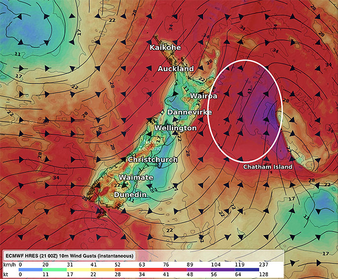
Below are the wind GUST maps over the next couple of days:
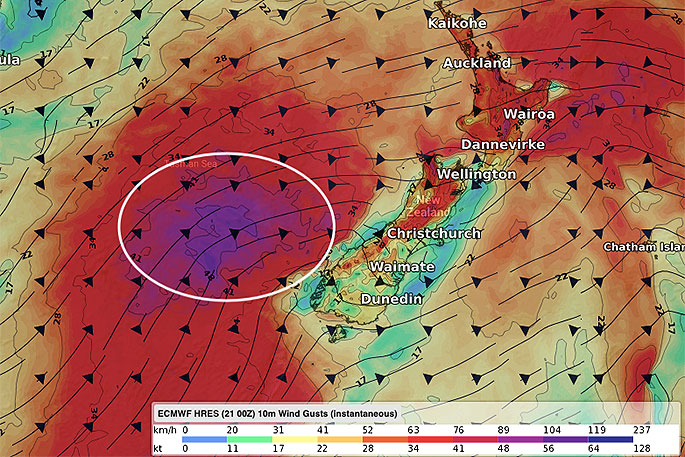
 6pm Tuesday.
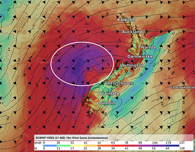
 Midnight tonight.
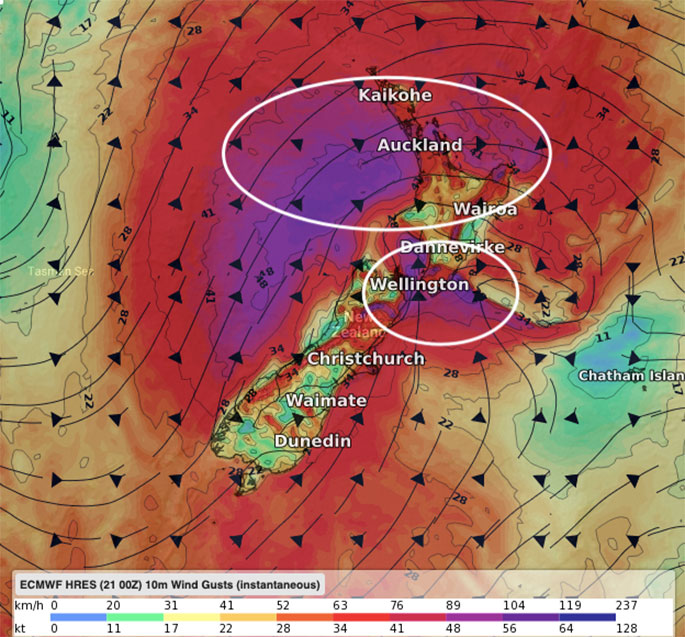
 6am Wednesday.
 Noon Wednesday.
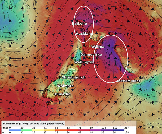 3pm Wednesday.
 9pm Wednesday.

0 comments
Leave a Comment
You must be logged in to make a comment.